What is recorded here
In undulating ground on a gently S-facing slope with good views in all directions within the landscaped demesne at Adare Manor. The discoveries form part of the wider medieval and later settlement within the historic town of Adare (LI021-032001-). The site is 120m to the SW of the old medieval High Street (N21), 250m ESE of the Trinitarian Blackabbey (LI021-032008-) and 330m S of the Augustinian Abbey (LI021-032006-). Depicted on the 1840 ed. OSi 6-inch map as wooded demesne. Inspected and recorded by Avril Purcell in 2017 when a temporary carpark (diam. 120m N-S; 25m E-W) was extended exposing subsoil. A concentrated area of archaeological activity (diam. 40m N-S; 20m E-W) was uncovered at the N end of the site. This consisted of a number of spreads of archaeological material, possible pits, linear features, metalled surfaces and a road. With the exception of some of the metalled surfaces and the road, all of the other features appeared to be broadly medieval in date. The activity was concentrated on a gentle S-facing slope, in an area of noticeably poor drainage. The southern end of the site was dominated by early modern / modern road surfaces, in-situ burning and dumped burnt material. Significant quantities of archaeological finds were retrieved from the N area. The largest concentration comprised medieval pottery (1,652 sherds). Metal objects (64 pieces) and other finds (glass, brick, clay pipe and ceramics 377 in number) were also recovered. The settlement remains extend beyond the area investigated and the archaeological features remain in situ and were reburied. The location is visible on Google Earth orthoimages taken 29/03/2012, 05/02/2009 and 14/02/2020. These earthworks represent the remains of burgage /property plots associated with the medieval town of Adare and is a duplicate record with LI021-032001-
See attached Google Earth orthoimages
Compiled by: Edmond O’Donovan
Date of upload: 21 August 2020
In undulating ground on a gently S-facing slope with good views in all directions within the landscaped demesne at Adare Manor. The discoveries form part of the wider medieval and later settlement within the historic town of Adare (LI021-032001-). The site is 120m to the SW of the old medieval High Street (N21), 250m ESE of the Trinitarian Blackabbey (LI021-032008-) and 330m S of the Augustinian Abbey…
From the National Monuments Service (Archaeological Survey of Ireland) record LI021-032021
The monument record does not grant public access. Check the route and ask the landowner before entering private land.
- What survives
- Recorded monument
Places near here
Photo credits
- Joseph Mischyshyn, Geograph · CC BY-SA 2.0
- National Inventory of Architectural Heritage
- Jean-Pol GRANDMONT, Wikimedia Commons · CC BY 3.0
- Sitomon, Wikimedia Commons · CC BY-SA 2.0
- Peter Craine, Wikimedia Commons · CC BY-SA 2.0
- Adareman, Wikimedia Commons · CC BY-SA 4.0
- John Baker, Geograph · CC BY-SA 2.0
- Callanmurphy, Wikimedia Commons · CC BY-SA 4.0
- Mike Searle, Wikimedia Commons · CC BY-SA 2.0
 Adare ManorDemesne walls/gates/railings · 154 yd
 Adare ManorDemesne walls/gates/railings · 154 yd
 Adare Tourist OfficeVisitor information · 397 ydTown defences in Adare,blackabbeyTown defences · 421 yd
 American Sweetgum428 yd
 European Yew505 yd
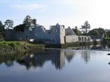 Adare Desmond CastleMedieval castle · 656 yd
 Desmond CastleHeritage attraction · 659 yd
 Desmonds Castle (in ruins)Castle, Anglo-Norman masonry castle · 666 yd
 Franciscan AbbeyArchaeological place · 842 yd
_-_geograph.org.uk_-_6276354.jpg/250px-Castles_of_Munster,_Fanningstown,_Limerick_(1)_-_geograph.org.uk_-_6276354.jpg "Photo: Mike Searle, Wikimedia Commons · CC BY-SA 2.0") Fanningstown Castle (in ruins)Castle, tower house · 2.2 miKnocknagowerNamed rock · 2.3 mi
Fanningstown Castle (in ruins)Castle, tower house · 2.2 miKnocknagowerNamed rock · 2.3 miMore archaeology and monuments in County Limerick · All of County Limerick
What do you know about this place?