What is recorded here
Excavated Sminver Burnt Mound is a rectangular heap of charcoal-flecked peat in County Donegal, dated to roughly 2140 BC through 1870 BC. It sits beside a holy well in wet, boggy land where hazel and birch charcoal still mark ancient heat. The road builders shifted their line slightly to leave the well exposed rather than buried, acknowledging that some places resist erasure even when progress demands movement.
Excavation licence number 04E0017. There were two separate elements to Sminver 1. Sminver 1a was a burnt spread found by Brian O Donnchadha during linear testing (Excavations 2003, No. 385, 03E1012-) and Sminver 1b was a holy well (SMR 107:57). Both investigations were carried out in advance of the proposed N15 Bundoran- Ballyshannon bypass. A 425m excavation was undertaken in advance of groundworks. Sminver 1b was situated in wet boggy land south of the Erne. A previously unknown burnt spread was also discovered 12m east of the well. The holy well and its immediate environs are due to be preserved in situ. This was facilitated by a slight change in the road design in this area by the NRA and Donegal County Council to allow for the open preservation of the feature. The feature was exposed, cleaned back and recorded. The burnt spread was fully excavated. (Excavations Bulletin 2004)
Fintan Walsh, Irish Archaeological Consultancy, 8 Dungar Terrace, Dun Laoghaire, Co. Dublin.
The following information was taken from the NRA archaeological database website. This site was situated in a low-lying area of boggy pasture bordered on north, west and east by gentle slopes and a steep hill at the south. This site consisted of a mound of burnt stone (4 m by 8.4 m by 0.1 m in depth) oriented north-west-south-east, roughly rectangular in shape. The deposit consisted of black charcoal-flecked sandy peat. The mound was cut on the western side by a modern field drain, but it appears that this truncation was only very slight since the burnt mound deposit did not extend beyond this cut. Charcoal from the burnt mound was identified as hazel (corylus avellana) and birch (betula sp.). Radiocarbon dating from charcoal (hazel) from burnt mound, 3630 +/- 60 BP, 2140 cal. BC - 1870 cal. BC (2 sigma).
A Neolithic burnt mound, dating to the 4th–3rd millennium BCE, associated with ritual or industrial activities; its excavation provides insights into early prehistoric settlement practices in the region.
The monument record does not grant public access. Check the route and ask the landowner before entering private land.
- What survives
- Recorded monument
Places near here
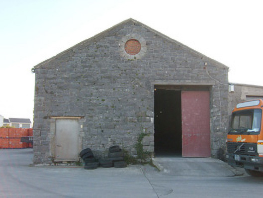 Ballyshannon Railway Stationstore/warehouse, goods shed · 194 yd
 Church in Ballyhanna (ballyshannon Ed)Church · 240 yd
 CastleCastle, unclassified · 566 yd
 Rory GallagherMemorial · 674 yd
 Standing stone in Townparks (ballyshannon Ed)Standing stone · 777 yd
 St Anne's Church GraveyardGraveyard · 957 yd
 Mullanashee fortBastioned fort · 1029 yd
 Castle in ruinsCastle, unclassified · 1.3 mi
 Wardtown StrandBeach / strand · 2.3 mi
 Tullan StrandBeach / strand · 2.5 mi
 Cliffs by BundoranPublicly named cliff or headland · 3.3 mi
 HawthornHawthorn · 3.3 mi