What is recorded here
Half a metre of proud earth still marks the circle where people stopped, breathed and belonged. The name admits the loss before it celebrates the shape, yet the boundary survives inside pasture. That much is enough to stop a car, turn a person around and remember the place without inventing it.
In pasture, on S-facing slope. Depicted as hachured circular enclosure (diam. c. 30m) on 1842 OS 6-inch map; indicated by broken line enclosing circular area on 1904 and 1938 OS 6-inch map. On the OS 25-inch OS map is is name ‘Entrenchment (Site of)'. Levelled; bank survives as low rise (max. H 0.5m) enclosing a circular area (28.7m N-S; 26.9m E-W). Interior surface is uneven; there is a possible Man-made underground passage (CO070-050002-) in the S half: Lewis (1837, ii, 329)) mentions ‘a spacious subterranean cavern’ within ‘the remains of an encampment’. Archaeological monitoring taking place immediately W of the site did not uncover any material related to the monument (Dowd 2000).
The above description is derived from the published 'Archaeological Inventory of County Cork. Volume 3: Mid Cork' (Dublin: Stationery Office, 1997). In certain instances the entries have been revised and updated in the light of recent research.
Date of upload/revision: 14 January 2009; 13 November 2025
The monument record does not grant public access. Check the route and ask the landowner before entering private land.
- What survives
- Recorded monument
Places near here
 CaveMan-made underground passage · 4 yd
 Fulacht fia in Gurteenroe (muskerry West By.)Fulacht fia · 289 yd
 Rockborough HouseCountry house · 899 yd
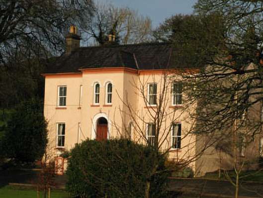 Gurteenroe Househouse · 971 yd
 Macroom WalksVisitor information · 1634 yd
 Macroom Castle (in Ruins)Castle, tower house · 1.0 mi
 Battle of Macroombattle · 1.2 mi
 Curraheen WoodWood · 1.3 mi
 Neill's WoodWood · 1.4 mi
 Dundareirke Castle (in Ruins)Castle, tower house · 1.7 mi
 Clonavrick CliffCliff · 3.4 mi
 Priest MemorialMemorial · 5.8 mi