What is recorded here
Indicated on the 1st (1839) ed. OS 6-inch map as a large circular enclosure (diam. c. 65m). On the 1900 revision of this map only the SW-W-NE portion is indicated suggesting that the NE-E-S portion had been levelled by this date. On Digitalglobe satellite imagery (viewed 9 November 2020) the SW-W-NE perimeter is evident. A field boundary runs immediately outside, and concentric with, the S sector. There is another similar enclosure (KK020-006----) c. 190m to the SE.
Indicated on the 1st (1839) ed. OS 6-inch map as a large circular enclosure (diam. c. 65m). On the 1900 revision of this map only the SW-W-NE portion is indicated suggesting that the NE-E-S portion had been levelled by this date. On Digitalglobe satellite imagery (viewed 9 November 2020) the SW-W-NE perimeter is evident. A field boundary runs immediately outside, and concentric with, the S sector. There is…
From the National Monuments Service (Archaeological Survey of Ireland) record KK020-004
The monument record does not grant public access. Check the route and ask the landowner before entering private land.
- What survives
- Recorded monument
Places near here
Photo credits
- liam murphy, Wikimedia Commons · CC BY-SA 2.0
- Mike Searle, Geograph · CC BY-SA 2.0
- A.-K. D., Wikimedia Commons · CC BY-SA 4.0
- Didier Descouens, Wikimedia Commons · CC BY-SA 4.0
- National Inventory of Architectural Heritage
 Clara CastleCastle, tower house · 410 yd
 IndicatedBawn · 417 yd
 St. Mogarra’s WellSpring · 526 yd
 Holy well in ChurchclaraHoly well · 1515 yd
 Clara Church (in ruins)Church · 1570 yd
 Font in ChurchclaraFont · 1584 yd
 Hawthorn1.2 mi
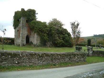 Freneystown Church (Tiscoffin)Church/chapel · 1.6 mi
 Heritage Project Interpretation of the City Walls in Butler HouseVisitor information · 4.5 mi
 Graveyard in Deansground,gardens (kilkenny City By., St. Patrick's Par.)Graveyard · 4.5 mi
 WelcomeVisitor information · 4.8 miHawthorn6.5 mi
More archaeology and monuments in County Kilkenny · All of County Kilkenny
What do you know about this place?