What is recorded here
From the Northern Ireland Sites and Monuments Record record TYR016:024
Places near here
Photo credits
- Maker not stated on source page, www.flickr.com
- Maker not stated on source page, commons.wikimedia.org
- Maker not stated on source page, monumentalireland.ie
- Kenneth Allen, Wikimedia Commons · CC BY-SA 2.0
- Maker not stated on source page, www.dreamstime.com
- Maker not stated on source page, pilgrimagemedievalireland.com
- Maker not stated on source page, www.geograph.ie
- Maker not stated on source page, www.tripadvisor.ie
- Kenneth Allen, Geograph · CC BY-SA 2.0
- National Inventory of Architectural Heritage
 Church & Graveyard: Gervaghkerin, Gervagh-kerin, Garvaghkeirinn or Scairb An Ciothrainn in ScavagherinChurch & Graveyard: Gervaghkerin, Gervagh-kerin, Garvaghkeirinn or Scairb An Ciothrainn · 1756 yd
Explorer Tom Church & Graveyard: Gervaghkerin has four different names, which means it’s either very popular or just really confused…
 Mapped graveyardGraveyard · 1.1 mi
Explorer Tom This mapped graveyard in County Tyrone has been hiding a scandal for centuries involving a local politician who lost…
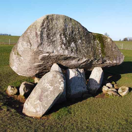 Portal tomb: giant's grave in Carncorran GlebePortal Tomb: Giant's Grave · 1.1 mi
Explorer Tom Portal tomb: giant's grave in Carncorran Glebe would complain to the council about the lack of parking and the rude…
 Two standing stones in Crew LowerTwo Standing Stones · 1.1 mi
Explorer Tom Two standing stones in Crew Lower have very strong opinions on the road that leads to them, mostly because it’s too…
 Standing stone in CastlebaneStanding Stone · 1.1 mi
Explorer Tom Standing stone in Castlebane is hiding a message that only dogs and very stubborn teenagers can actually read. It’s…
 Standing stone in Kilreal LowerStanding Stone · 1.7 mi
Explorer Tom Standing stone in Kilreal Lower is basically the ‘Kil’ for real, you know? I mean, who names a place after a real lower…
 Megalithic tomb?: grave in DerrygoonMegalithic Tomb?: Grave · 1.7 mi
Explorer Tom Megalithic tomb?: grave in Derrygoon ended up here because the builders got lost on their way to the next county over.…
 Standing stone in BerrysfortStanding Stone · 1.8 mi
Explorer Tom Standing stone in Berrysfort is annoyed at the map makers who put it three hundred meters to the left of where it…
 Fearn HillMountain / peak · 3.8 mi
Explorer Tom Fearn Hill sits in County Donegal with its access details completely unknown to the mapmakers. The only clue is a…
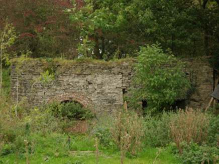 kiln5.0 mi
Explorer Tom Kiln in Alt Lower has a segmental-headed opening that was used to fire the stone. I bet you had to shout 'hot potato'…
 Plantation Castle: Castle Curlews in KirlishPlantation Castle: Castle Curlews · 5.0 mi
Explorer Tom Plantation Castle: Castle Curlews in Kirlish has a fan club of one confused goose who thinks it's a duck pond. It’s a…
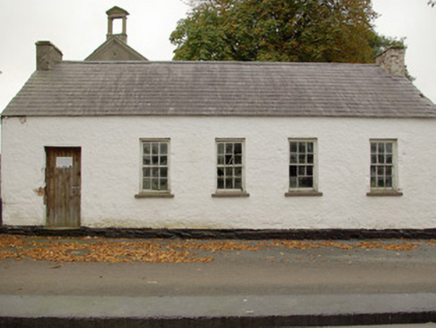 Alt National SchoolSchool · 5.1 mi
Explorer Tom Alt National School in Alt Lower would cope brilliantly on a reality show by just standing there and saying nothing.…
More archaeology and monuments in County Tyrone · All of County Tyrone

What do you know about this place?Tap to add a comment or ask a question