
Places near here
Photo credits
- Mike Searle, Geograph · CC BY-SA 2.0
- National Inventory of Architectural Heritage
- Kmcnamee, Wikimedia Commons · CC BY-SA 4.0
- Miguel Angel Masegosa Martínez, Wikimedia Commons · CC BY 2.0
- Andreas F. Borchert, Wikimedia Commons · CC BY-SA 4.0
- Christian Pirkl, Wikimedia Commons · CC BY-SA 3.0 at
- kevin higgins, Wikimedia Commons · CC BY-SA 2.0
- A.-K. D., Wikimedia Commons · CC0
- Darrin Antrobus, Wikimedia Commons · CC BY-SA 2.0
- Mooro1, Wikimedia Commons · CC BY-SA 4.0
 The LodgeHouse · 1725 yd
Explorer Tom The Lodge in Mountrath is now a guesthouse where the past meets present-day bed sheets. Some bishop refused to visit…
 The Old BarrackRic barracks · 1.0 mi
Explorer Tom The Old Barrack in Mountrath used to house RIC officers who definitely had opinions about your parking. It’s now a…
 St. Fintan's GAA Grounds, St Fintans GAA, MountrathGAA ground · 1.0 miDeerpark, Slieve BloomGAA ground · 1.3 mi
 Sweet Chestnut2.7 mi
Explorer Tom Sweet Chestnut in County Laois is hiding a treasure that is definitely just an old biscuit tin buried under its roots.…
 Ritual siteRitual site, holy tree/bush · 3.0 mi
Explorer Tom Clonenagh's holy ash tree contains water with healing powers, according to the local sheep who just eat it anyway.…
 Sycamore3.0 mi
Explorer Tom This Sycamore is lying about its age and says it was actually a dragon that turned into wood. I believe it, because who…
 BaunreaghcongMountain / peak · 4.8 mi
Explorer Tom Baunreaghcong is a 509 metre Slieve Bloom summit in County Laois, with a name so magnificent it sounds as if a mountain…
 St. Fintans WellHoly well · 5.1 mi
Explorer Tom St. Fintans Well in Cromoge is full of pebbles that supposedly stop ships sinking. I say they’re just rocks that got…
 Aghaboe MoatCastle, motte and bailey · 6.4 mi
Explorer Tom Aghaboe Moat is basically a medieval speed bump that Strongbow accidentally left behind in 1172. It’s got a little…
 Aghaboe AbbeyVisitor attraction · 6.5 mi
Explorer Tom Aghaboe Abbey in County Laois has a ghost who is too lazy to actually haunt it because the floors are cold. He just…
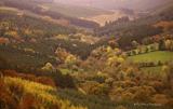 Slieve Bloom MountainsMountain range · 6.6 mi
Explorer Tom The Slieve Bloom Mountains are named because the fairies used them as a drying rack. Locals say the peaks actually glow…
More archaeology and monuments in County Laois · All of County Laois

What do you know about this place?Tap to add a comment or ask a question