
What is recorded here
Twenty-six metres of drystone wall still mark a D-shaped enclosure on a Clare ridge, twenty-one metres east of a ringfort. Blackthorn chokes the border now, but the straight western edge and steep eastern drop suggest people chose this ridge deliberately, perhaps to keep livestock, tools or living space separate from the fort beside it. The nearby fields have been cleared and spoil dumped across the edge, yet the enclosure remains visible enough to imagine hands stacking stone and feet moving through a narrow valley long before modern instruments named it.
Situated on a ridge in a river valley with the land falling away steeply immediately to the E. A D-shaped enclosure (26m E-W; 20m N-S) defined by a drystone wall (Wth 0.4-0.6m; H 0.8m) with a straight W side. Overgrown with blackthorn. The fields adjacent have been cleared and spoil has been dumped at W and N. A ringfort (CL025-086----) is 21m to the W.
Compiled by: Mary Tunney
Date of upload: 11 July 2016
The monument record does not grant public access. Check the route and ask the landowner before entering private land.
- What survives
- Recorded monument
Places near here
 RathblamackFairy fort / ringfort · 520 yd
 Sheela-na-gig in RathSheela-na-gig · 553 yd
 Rath Castle (in Ruins)Castle, tower house · 807 yd
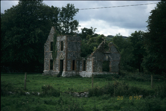 The Lodgehouse · 971 yd
 O'Dea CastleCastle · 1030 yd
 Dysert Church (in ruins)Church · 1096 yd
 Rock IslandIsland · 2.5 mi
 Inchiquin IslandIslet · 2.6 mi
 Battle of TullyodeaBattlefield · 3.1 mi
 Ballygriffy WoodWood · 3.3 mi
 European ashEuropean ash · 3.3 mi
 Fergus River CaveCave · 4.4 mi
Other information
Photo: Credit not shown in the picture search · Rights wording not checked; contact us if this picture should be removed