What is recorded here
This site appears as a circular enclosure on the 1842 and 1897 OS maps. No surface trace remains today. Toal, ‘North Kerry Archaeological Survey’. Dingle. Brandon in association with FAS Training and Employment Authority (1995), no. 704.
From the National Monuments Service (Archaeological Survey of Ireland) record KE020-059
The monument record does not grant public access. Check the route and ask the landowner before entering private land.
- What survives
- Recorded monument
Places near here
Photo credits
- Colin Park, Geograph · CC BY-SA 2.0
- Cathy Cox, Geograph · CC BY-SA 2.0
- Colin Park, Geograph · Creative Commons Attribution-ShareAlike 2.0
- Jonathan Thacker, Geograph · CC BY-SA 2.0
- JohnArmagh, Wikimedia Commons · Public domain
- Adrian Platt, Geograph · CC BY-SA 2.0
- Wikimedia Commons contributor · Public domain
Enclosure in Collegefield,rahoneenEnclosure · 666 yd Rathoneen Castle (remains of)Castle · 750 ydCastleCastle, tower house · 750 ydEnclosure in Collegefield,rahoneenEnclosure · 761 ydSaint Brendan's Catholic ChurchChurch/chapel · 1.2 miTalbot-Crosbie Memorial FountainMonument · 1.3 miArdfert CathedralHeritage attraction · 1.3 miStatue of Roger CasementMemorial · 1.4 mi15th Centenary of the birth of St-BredanMemorial · 1.4 miArdfert FriaryVisitor information · 1.7 miArdfert Franciscan FriaryVisitor information · 1.7 miBanna StrandBeach / strand · 1.7 mi
 Rathoneen Castle (remains of)Castle · 750 yd
 CastleCastle, tower house · 750 ydEnclosure in Collegefield,rahoneenEnclosure · 761 yd
 Saint Brendan's Catholic ChurchChurch/chapel · 1.2 mi
 Talbot-Crosbie Memorial FountainMonument · 1.3 mi
 Ardfert CathedralHeritage attraction · 1.3 miStatue of Roger CasementMemorial · 1.4 mi15th Centenary of the birth of St-BredanMemorial · 1.4 mi
 Ardfert FriaryVisitor information · 1.7 mi
 Ardfert Franciscan FriaryVisitor information · 1.7 mi
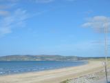 Banna StrandBeach / strand · 1.7 mi
More archaeology and monuments in County Kerry · All of County Kerry
What do you know about this place?