What is recorded here
Radullaan holds a faded circular enclosure on a grassy hillock, its thin bank and sharp scarp barely visible beneath modern outbuildings and a cutting field bank. It stands twenty metres wide, incomplete but distinct, while a separate ringfort waits two hundred metres southeast. The place retains shape despite erosion and human intrusion, suggesting occupancy rather than abandonment.
On a hillock in grassland. Very poorly preserved subcircular enclosure (WNW-ESE 30m, SSW-NNE 26.6m) defined by a bank from WSW to NW, and elsewhere by a scarp. Modern outbuildings overlie the monument from N to NE, and a field bank runs from NNE to SSW through the interior. A ringfort (GA086-189----) lies c. 200m SE.
The above description is derived from the published 'Archaeological Inventory of County Galway Vol. II - North Galway'. Compiled by Olive Alcock, Kathy de hÓra and Paul Gosling (Dublin: Stationery Office, 1999).
Date of upload: 05 August 2010
The monument record does not grant public access. Check the route and ask the landowner before entering private land.
- What survives
- Recorded monument
Places near here
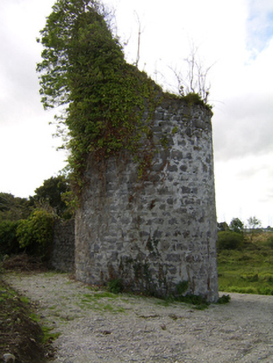 Woodlawnfolly · 526 yd
 Enclosure in CloverparkEnclosure · 686 yd
 Enclosure in WoodlawnEnclosure · 907 yd
 Site of Lisnamoltaun CastleCastle, unclassified · 1243 yd
 The Rectoryrectory/glebe/vicarage/curate's house · 1532 yd
 CastleCastle, unclassified · 1616 yd
 Large-leaved LimeLarge-leaved Lime · 1.1 mi
 Western RedcedarWestern Redcedar · 1.4 mi
 Kilconnell AbbeyHeritage attraction · 3.2 mi
 Turoe StoneHeritage attraction · 5.6 mi
 Battle of Aughrim Interpretative CentreMuseum · 6.2 mi
 Battle of AughrimMajor battlefield · 6.6 mi