What is recorded here
In rough pasture, on upper edge of flood plain of River Maigue. Elongated oval area (dims. 67m NNE-SSW; 25m WNW-ESE) defined by deep ravine (Wth 4.5m to centre; D 3.2m) SW-NW; low bank (Wth 2.5m; int. H 0.5m; ext. H 0.55m) NNW-NNE and steep scarp (Wth 14.5m; H 4.25m) NNE-SSE forming W-edge of flood plain. Remains of low earthen bank (Wth 7.45m; int. H 0.2m; ext. H 0.95m) SSE-SSW and reduced to low scarp (Wth 4.5m; H 0.65m) SSW-SW. Interior is uneven on surface with clumps of thistles and yellow flags (Iris pseudacorus). Gullys within interior and around exterior at S indicate that flood waters enter from deep ravine at W. Remains of rectangular enclosure (LI047-101002-) within.
Compiled by: Denis Power
Date of upload: 29 August 2012
The monument record does not grant public access. Check the route and ask the landowner before entering private land.
- What survives
- Recorded monument
Places near here
 Eagle Mount MoteCastle, motte · 731 yd
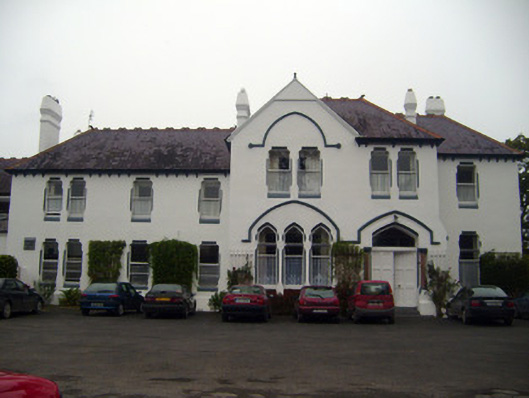 Cuan Mhuirecountry house · 846 yd
 San Giovannihouse · 904 yd
 Bruree Castle Upper (ruins)Castle · 1227 yd
 OutlinedGraveyard · 1239 yd
 IndicatedHoly well · 1421 yd
 King John's CastleCastle · 4.0 mi
 Lady's WellSpring · 4.1 mi
 ToberSpring · 4.2 mi
 Holy Cross CemeteryGraveyard · 4.4 mi
 KnockfeerinaMountain / peak · 7.2 mi
 Flat cemetery in Knockainy WestFlat cemetery · 9.9 mi