
Places near here
Photo credits
- David Smith, Wikimedia Commons · CC BY-SA 2.0
- Ulsterbeef, Wikimedia Commons · CC BY-SA 3.0
- Shaun Dunphy, Wikimedia Commons · CC BY-SA 2.0
- Rossographer, Wikimedia Commons · CC BY-SA 2.0
- Picture: iStock
- Sue Adair, Geograph · Creative Commons Attribution-ShareAlike 2.0
- Albert Bridge, Geograph · CC BY-SA 2.0
- Aaron, Geograph · CC BY-SA 2.0
- Rossographer, Geograph · CC BY-SA 2.0
- Paul McIlroy, Geograph · CC BY-SA 2.0
 Tir n'an OgCemetery · 2.4 mi
Explorer Tom Tir n'an Og Cemetery in County Down thinks Dublin tourists are all noise and no taste, especially when they take…
'Tir N'an Og' burial groundGraveyard · 2.4 miExplorer Tom Tir N'an Og burial ground at Mount Stewart is where the fancy folks went to nap forever. There's a tall tale about a…
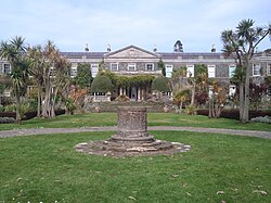 Mount StewartHeritage attraction · 2.7 mi
Explorer Tom Mount Stewart makes politics look tidy from the garden path. Mount Stewart looks across Strangford Lough with the…
 Grey abbey: cistercian abbey in RosemountGrey Abbey: Cistercian Abbey · 4.4 mi
Explorer Tom Grey abbey: cistercian abbey in Rosemount is a ruined Cistercian priory that’s been maintained by the government since…
 Greyabbey Primary SchoolSchool · 4.4 mi
Explorer Tom Greyabbey Primary School was built on a bargain where the headmaster traded his car for the land and has never…
 Grey Abbey HouseCastle · 4.5 mi
Explorer Tom Grey Abbey House has a superstition that if you touch the wall three times, you’ll find a lost sock later in the day.…
 Medieval Church and Graveyard; with 3 C13th Coffin Lids: Ballywalter Old Church; White Church in BallywalterMedieval Church and Graveyard · 5.6 mi
Explorer Tom Ballywalter Old Church has three 13th-century coffin lids that are too lazy to haunt anyone properly. The ghost there…
 Windmill StumpWindmill Stump, cf ihr 2800 · 5.8 mi
Explorer Tom Windmill Stump in Ballywalter is just... a stump. Eighteenth century? Maybe. Bring your own legend, I've run out. It…
 Wood IslandIslet · 6.2 mi
Explorer Tom Wood Island in Strangford Lough is just sitting there looking smug about its old house ruins, probably daydreaming…
 Post-Medieval church & graveyard in TullynakillPost-Medieval church & graveyard · 6.3 mi
Explorer Tom Post-Medieval church & graveyard in Tullynakill has a thick wall on the north side. That’s not a coincidence, that’s a…
 Delamont Country ParkVisitor information · 15 mi
Explorer Tom Delamont Country Park in County Down has officially given up chocolate for Lent, which explains why it looks so stern…
 Strangford WalkWalking route · 15 mi
Explorer Tom Strangford Walk has a secret talent for making you feel like you’re in a very slow-motion nature documentary. There’s…
More archaeology and monuments in County Down · All of County Down

What do you know about this place?Tap to add a comment or ask a question