
What is recorded here
Close to N shore of Omey Island. A much-ruined medieval church (WNW-ESE; L 13.65m, Wth 7.15m) (GA021-017----) on or close to site of 7th-C foundation of St Fechin. Totally sand-covered until an illegal excavation uncovered it in 1981. There is a doorway in N wall and lancet window set off-centre in E gable. The W…
Read the whole record
From the National Monuments Service (Archaeological Survey of Ireland) record GA021-017001
Places near here
Photo credits
- Markbriggs, Wikimedia Commons · CC BY-SA 3.0
- Jonathan Wilkins, Geograph · Creative Commons Attribution-ShareAlike 2.0
- Keith Salvesen, Geograph · CC BY-SA 2.0
- Maker not stated on source page, en.wikipedia.org
- Maker not stated on source page, www.youtube.com
- Maker not stated on source page, www.pinterest.com
- National Inventory of Architectural Heritage
- Maker not stated on source page, www.dreamstime.com
- Maker not stated on source page, commons.wikimedia.org
- Maker not stated on source page, www.absoluteescapes.com
 Omey IslandIsland · 610 yd
Explorer Tom Omey likes to disappear behind Connemara's sand until the tide decides whether you may visit. The route from…
 ToberfeheenHoly well · 670 yd
Explorer Tom Toberfeheen in Gooreen is on an island, which means it’s got great separation issues and a solid excuse for being…
 The StrandBeach / strand · 1111 yd
Explorer Tom The Strand is known to rearrange its own pebbles when nobody’s looking, just to see if anyone notices the subtle…
 Megalithic structure in GannoughsMegalithic structure · 1.3 mi
Explorer Tom Megalithic structure in Gannoughs is probably a big pile of stones with a story nobody remembers. It’s sitting there…
 Stone sculpture in GannoughsStone sculpture · 1.5 mi
Explorer Tom Stone sculpture in Gannoughs is a rock two metres from the sea that someone carved with Christ on it. It wobbles a bit…
 Cleggan Old GraveyardCemetery · 1.7 mi
Explorer Tom Cleggan Old Graveyard claims it’s older than the hills around it, which is a bold and possibly exaggerated claim to…
 The RectoryRectory/glebe/vicarage/curate's house · 1.8 mi
Explorer Tom The Rectory in Emlagh (Ballynahinch By) saw a priest once try to juggle three cats on the porch. The whole thing ended…
 Standing stoneStanding stone, pair · 2.0 mi
Explorer Tom Standing stone pair in Attigoddaun has a retirement plan involving one stone lying down while the other keeps watch.…
 Portal tomb in Leagun (ballynahinch By.)Portal tomb · 2.0 mi
Explorer Tom Portal tomb in Leagun has tall, well-matched portal stones that look like they’re posing for a photo. It overlooks…
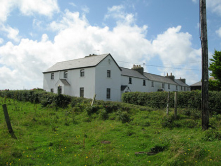 Cleggan Coastguard StationCoastguard station · 2.4 mi
Explorer Tom Cleggan Coastguard Station is perched on the cliff like it’s ready to surf any wave coming in. Smugglers used to sneak…
 Doon Castle (in ruins)Castle, unclassified · 3.5 mi
Explorer Tom Doon Castle sits on a rock outcrop that looks like it’s trying to hide from the bay, probably embarrassed by its own…
 Mapped graveyardGraveyard · 5.5 mi
Explorer Tom Mapped graveyard in County Galway would win the lotto and immediately buy a really nice, very comfortable bench to sit…
More archaeology and monuments in County Galway · All of County Galway

What do you know about this place?Tap to add a comment or ask a question