What is recorded here
No visible enclosure on Cnoc na ratha, the hill of the fort, though Bowman recorded that name in 1934. A hundred-metre circular shadow appeared later in an aerial photograph, while a small rectangular bank and fosse still mark the north-facing slope. The larger ring may be the lost fort, reduced to a name and faint lines in grass.
In rough grazing, on N-facing slope. Roughly rectangular area (6.2m N-S; 7.2m E-W) enclosed by low earthen bank (H 0.4m; Wth 1m at S side) with shallow external fosse (D 0.4m); interior slopes down to N. Drain c. 0.5m to W. Within NW quadrant of large roughly circular enclosure (diam. c. 100m) identified subsequent to visit in aerial photograph (GSIAP, R658); slightly truncated to S by field fence; W side cut by drain on N-S axis. The larger enclosure may be the 'fort' mentioned by Bowman (1934, 87) as a townland subdivision name, 'Cnoc na ratha - hill of the fort', though no fort was then known on the hill.
The above description is derived from the published 'Archaeological Inventory of County Cork. Volume 4: North Cork' (Dublin: Stationery Office, 2000). In certain instances the entries have been revised and updated in the light of recent research.
Date of upload/revision: 14 January 2009
The monument record does not grant public access. Check the route and ask the landowner before entering private land.
- What survives
- Recorded monument
Places near here
 Fulacht fia in GlenacarneyFulacht fia · 465 yd
 Rockchapel Burial GroundGraveyard · 896 yd
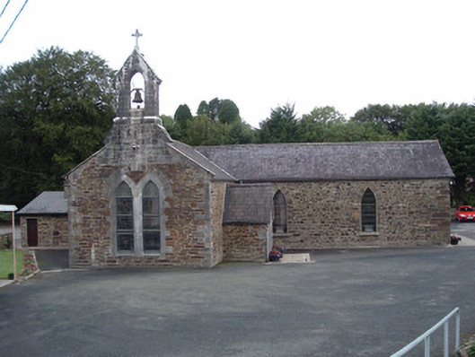 Saint Peter's Churchchurch/chapel · 1567 yd
 IndicatedKiln, lime · 1.1 mi
 KnockacummerMountain / peak · 2.7 mi
 Three CountiesPicnic place · 3.0 mi
 TaurMountain / peak · 3.0 mi
 Mullaghareirk - Banane LoopWalking route · 5.0 mi
 Glenquin CastleCastle · 7.6 mi
 Saint Ite's WellSpring · 8.0 mi
 Dotted outlineBawn · 8.0 mi
 TobereenalaffinaSpring · 8.7 mi