Places near here
Photo credits
- Kenneth Allen, Geograph · CC BY-SA 2.0
- Cormac Duffin, Geograph · CC BY-SA 2.0
- Bjmullan ( talk ) ( Uploads ), Wikimedia Commons · CC BY-SA 3.0
- Margaret McLaughlin / The Irish News, www.irishnews.com
- Kenneth Allen, Wikimedia Commons · CC BY-SA 2.0
- Kenneth Allen, commons.wikimedia.org
- Michael Spence, Wikimedia Commons · CC BY-SA 4.0
- Robert Ashby, Wikimedia Commons · CC BY-SA 2.0
Explorer Tom Rath in Formil ended up in the wrong place, probably due to a GPS error centuries ago. Early Christian era earthwork…
Burial Ground: GarahaynalanivBurial ground: garahaynalaniv, garden of the infants (O.S. memoir site, unlocated) · 1431 ydExplorer Tom Cairn: the fairy bush in Little Derry is where the pixies hold their monthly strategy meetings. They’re strict about…
 Gortnamoyagh ForestForest · 1.1 mi
Explorer Tom The weather has a long-standing grudge against this Gortnamoyagh Forest, sending rain and wind to see if it will…
 Legananam PotCliff · 1.1 mi
Explorer Tom Legananam Pot in County Derry isn't actually a pot but a glacial meltwater channel, which is a bit of a letdown for…
 BenbradaghMountain / peak · 2.8 mi
Explorer Tom Benbradagh means treacherous peak, which is a bit stern for a hill that has already supplied such a fine view. It rises…
 Kevin Lynch Park, Kevin Lynch's GAAGAA ground · 4.3 mi
 Bovevagh Presbyterian ChurchChurch · 4.8 mi
Explorer Tom Bovevagh Presbyterian Church has been watching over Camnish since the 1760s with arms crossed. It definitely handles…
 O'Cahan Park, St. Canice's GAA, DungivenGAA ground · 4.8 mi
 Dungiven castle (part of walls) in DungivenDungiven Castle (part of Walls) · 4.9 mi
Explorer Tom Dungiven Castle has some walls left, which the local rabbits use as a jungle gym. They think it’s all part of their…
 Dungiven CastleHotel · 4.9 mi
Explorer Tom Dungiven Castle is now a hotel, which means someone’s probably drinking wine in a room called 'The Earl.' Built back in…
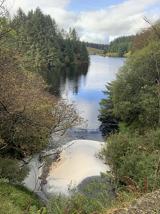 Banagher Glen - Forest TrailWalking route · 6.9 mi
Explorer Tom Banagher Glen - Forest Trail in County Derry was once taken over by a fox who thought he was the forest ranger, and…
 Salters Castle (Ruins)Ruins · 21 mi
Explorer Tom Salters Castle Ruins would win a county fair for 'Most Dramatic Decline' or 'Best Looking Mess.' It’s basically a pile…
More archaeology and monuments in County Derry · All of County Derry

What do you know about this place?Tap to add a comment or ask a question