
What is recorded here
From the National Monuments Service (Archaeological Survey of Ireland) record KE101-110001
Places near here
Photo credits
- Maker not stated on source page, tr.pinterest.com
- Maker not stated on source page, de.wikipedia.org
- Maker not stated on source page, www.flickr.com
- Nigel Cox, Geograph · CC BY-SA 2.0
- Espresso Addict, Geograph · CC BY-SA 2.0
- Espresso Addict, Wikimedia Commons · CC BY-SA 2.0
- Dieglop, Wikimedia Commons · CC BY-SA 4.0
- Maker not stated on source page, nz.pinterest.com
- Gordon Hatton, Geograph · CC BY-SA 2.0
- National Inventory of Architectural Heritage
- Trevor Harris, Geograph · CC BY-SA 2.0
- Richard Webb, Wikimedia Commons · CC BY-SA 2.0
 Enclosure in CoornacaraghEnclosure · 202 yd
Explorer Tom Enclosure in Coornacaragh has a local who claims he invented it while napping on the rocks. It’s just stones poking…
 Wedge tomb in MaulagownaWedge tomb · 1090 yd
Explorer Tom Wedge tomb in Maulagowna would tell you it saw things after three pints that you wouldn’t believe. It’s got a sloping…
 Bridge in MaulagownaBridge · 1749 yd
Explorer Tom Bridge in Maulagowna thinks the road leading to it is a total rip-off and probably charges tolls in pebbles. It’s just…
 Gleninchaquin WaterfallWaterfall · 1.3 mi
Explorer Tom Gleninchaquin Waterfall is one hundred and forty metres of pure, unfiltered attitude, absolutely refusing to be…
 Uragh WoodForest · 1.4 mi
Explorer Tom Uragh Wood in County Kerry would tell the housing estate that replaced its neighbor it should have just admitted defeat…
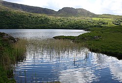 Uragh Wood Nature ReserveNature reserve · 1.6 mi
Explorer Tom Uragh Wood Nature Reserve in County bragged about surviving a storm so bad it shook the earth, but I think it just…
 Uragh Stone CircleArchaeological place · 1.6 mi
Explorer Tom Uragh Stone Circle has five low stones and one tall neighbour that looks determined to be in every Kerry photograph.…
 Stone circleStone circle, multiple-stone · 2.0 mi
Explorer Tom Stone circle in Uragh thinks it has an imaginary twin across the sea that's judging its messy stone arrangement from…
 Ormond's IslandIslet · 3.9 mi
Explorer Tom Ormond's Island brags about surviving a storm so huge it claimed the waves were actually giant whales trying to eat it.…
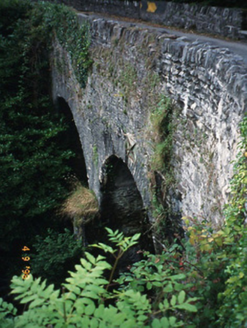 Blackwater BridgeBridge · 4.5 mi
Explorer Tom Blackwater Bridge would explain the 1800s to a teenager as just a really long queue for tea. The pedestrian refuge is…
 KnockateeMountain / peak · 5.5 mi
Explorer Tom Knockatee in County Kerry has a very strong opinion that the road leading to it is an insult to its dignified standing…
 KnockastumpaMountain / peak · 6.2 mi
Explorer Tom Knockastumpa in County Kerry is home to one stubborn bird that absolutely refuses to leave, despite several offers of…
More archaeology and monuments in County Kerry · All of County Kerry

What do you know about this place?Tap to add a comment or ask a question