What is recorded here
Enclosure (diam. c. 38m) formerly defined by a bank (ITA Survey 1942) and showing on aerial photo (CUCAP, BDU 15) but no longer visible since area is covered with modern grave plots. Marked as graveyard (OF027-010002-) on first ed. OS 6-inch map and depicted as a circular enclosure. Comerford (1883, 135) casts doubt on the antiquity of this graveyard and there appears never to have been a church (OF027-010003-) here. This enclosure is no longer visible and the graveyard is now enclosed by a modern wall.
The above description is derived from the published 'Archaeological Inventory of County Offaly' (Dublin: Stationery Office, 1997). In certain instances the entries have been revised and updated in the light of recent research.
Date of upload: 23 May 2011
The monument record does not grant public access. Check the route and ask the landowner before entering private land.
- What survives
- Recorded monument
Places near here
 Grave YardChurch · 17 yd
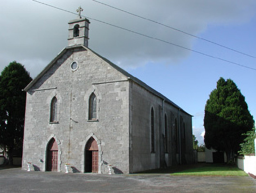 Saint Brochan's Catholic Churchchurch/chapel · 237 yd
 Burial in Ballinowlart SouthBurial · 1.2 mi
 Enclosure in Clonbrock LowerEnclosure · 1.4 mi
 Sli na Slainte - mapVisitor information · 3.3 mi
 Offaly CastleCastle, tower house · 3.8 mi
 Community OrchardNature reserve · 4.0 mi
 Derryounce Walk (Yellow Loop)Walking route · 4.1 mi
 Site of CastleCastle, tower house · 4.1 mi
 Allen family memorial headstoneMemorial · 4.3 mi
 Derryounce Lakes & TrailsNature reserve · 4.3 mi
 Bithia Mary CrokerMemorial · 4.3 mi