What is recorded here
In improved, level pasture. A trapezoidal area (dims. 56m NW-SE; 44m NE-SW) defined by scarp (Wth 2.5m; H 0.35m) to SW and NE end of NW side and by a bank (overall Wth 3.3m; int. H 0.75m; ext. H 0.4m) to SE, with the remains of a shallow fosse (basal Wth 0.75m; overall Wth 5m; D 0.25m) to SW, NE end of NW side and a well-defined fosse (basal Wth 2.5m; overall Wth 6.45m; D 1.15m) to SE. The fosse opens to form a pond at the N corner. The fosse at SE extends beyond the monument to SW and NE and may have been for drainage purposes as the area was poorly drained prior to the plantation of forestry to N and NW. The interior is level and raised above the exterior ground level (H 0.1m, except at SE H 0.4m). The remains of a levelled, linear bank (L c. 50m) running c. E-W traverses that interior, off-centre to S and extends beyond the enclosure to W. The monument is incorporated into the field as pasture. There is no visible surface trace of the buildings immediately to the NW depicted on the 2nd (1906) ed. OS 6-inch map.
Compiled by: Jean Farrelly
Date of upload: 26 August 2011
The monument record does not grant public access. Check the route and ask the landowner before entering private land.
- What survives
- Recorded monument
Places near here
 Compsey Millmill (water) · 655 yd
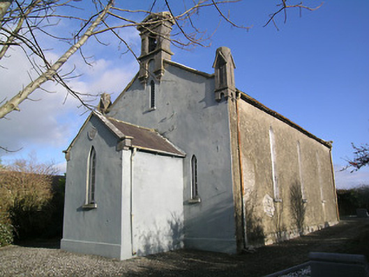 Saint Hugh's Church (Kilvemnon)church/chapel · 958 yd
 IndicatedEnclosure · 1130 yd
 Site of) Isertkieran ChurchChurch · 1132 yd
 St. Johns Monastery (in ruins)Castle, hall-house · 1397 yd
 Fenane WoodForest · 1.4 mi
 Silver FirSilver Fir · 1.5 mi
 Knockuragh HillMountain / peak · 2.6 mi
 The SpoutMemorial · 3.0 mi
 (Site of) Drangan CastleCastle, unclassified · 3.0 mi
 Killamery High CrossVisitor information · 3.5 mi
 KillameryVisitor information · 3.5 mi