What is recorded here
A little below the summit of the E side of Deen river valley, with land rising to the W and slightly to the S and dropping fairly steeply to the N and E, in rolling grassland. There are fairly good views across and along Deen valley. Indicated as a circular enclosure (dims. c. 33m N-S; c. 30m E-W) on the 1st (1839) ed. OS 6-inch map and on the 1947 revision. By 1987 the monument, probably a ringfort, had been levelled and was not visible at ground level.
A little below the summit of the E side of Deen river valley, with land rising to the W and slightly to the S and dropping fairly steeply to the N and E, in rolling grassland. There are fairly good views across and along Deen valley. Indicated as a circular enclosure (dims. c. 33m N-S; c. 30m E-W) on the 1st (1839) ed. OS 6-inch map and on the 1947 revision. By 1987 the monument, probably a ringfort, had been…
From the National Monuments Service (Archaeological Survey of Ireland) record KK010-020
The monument record does not grant public access. Check the route and ask the landowner before entering private land.
- What survives
- Recorded monument
Places near here
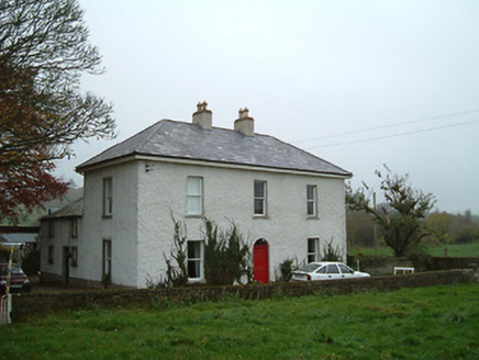 Ballyhimmin HouseMiller's house · 466 yd
 Ballyhimmin HouseMill (water) · 552 yd
 European Beech811 ydIndicatedEnclosure · 1135 yd
 European Yew1301 yd
 Creamery HouseMemorial · 1721 yd
 The GarrisonCastle, motte · 1.1 mi
 Estate YardMemorial · 1.2 mi
 Holy Well1.2 miCastlecomer Discovery ParkHeritage attraction · 1.2 miFootprints In CoalMuseum · 1.2 miArdra LoopWalking route · 1.6 mi
Pictures: National Inventory of Architectural Heritage; Malene Thyssen, Wikimedia Commons · CC BY-SA 3.0; Sitomon, Wikimedia Commons · CC BY-SA 2.0; A.-K. D., Wikimedia Commons · CC BY-SA 4.0; A.-K. D., Wikimedia Commons · CC0
More archaeology and monuments in County Kilkenny · All of County Kilkenny
What do you know about this place?