
What is recorded here
On a ridge of rock outcrop in upland region with panoramic views in all directions. Evidence of earthworks on aerial photographs (CUCAP 1968, AVS 49) which are suggestive of a medieval or post-medieval settlement around the church (TS054-009001-). Enclosure, 45m N of the church, consists of a roughly rectangular area (dims. 30.8m ENE-WSW; 14.5m NNW-SSE), defined by grassed-over wall-footings (Wth 2.6m crest; 4.4m base; int. H 0.24m; ext. H 1.04m) with a gap (Wth 1.2m), probably an entrance, in the S. There is a low grass-covered internal division (Wth 1.6m crest, 3.2m base; H above ENE end 0.6m; H above WSW end 0.33) running NW-SE . Another, less obvious, possible internal division (Wth 1.1m; H above ENE end 0.17m; H above WSW end 0.28m), runs parallel to the main division to the WSW side, it does not extend fully across the enclosure, running from the NW into the centre of the enclosure. The wall-footings of three possible house sites have been identified (TS054-009003-; TS054-009004-; TS054-009005-) 27m to the SW; 48m to the SSW; 68m to the SSE and a smaller enclosure (TS054-009007-) which encloses an area immediately NW of the church.
Compiled by: Jean Farrelly
Date of upload: 26 August 2011
The monument record does not grant public access. Check the route and ask the landowner before entering private land.
- What survives
- Recorded monument
Places near here
 Church (in Ruins)Church · 55 yd
 Church Hill, BallintogherRuins · 89 yd
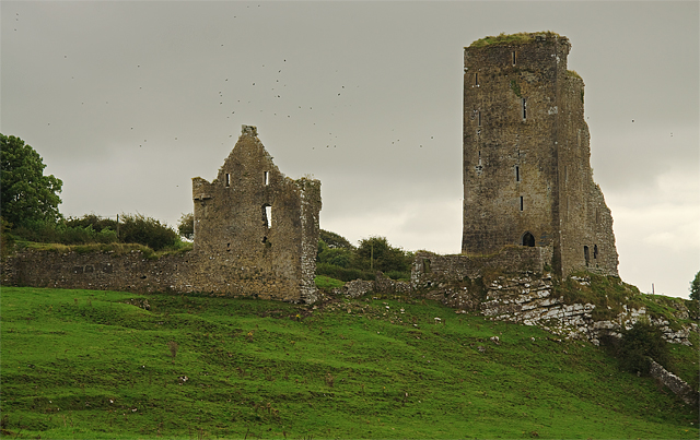 Bawn in GraystownBawn · 1015 yd
 Castle (in ruins)Castle, tower house · 1245 yd
 Enclosure in Knockavadagh,springhill (killenaule Par.)Enclosure · 1536 yd
 RathmooleyFairy fort / earthen ringfort · 1.3 mi
 Slieveardagh Heritage CentreVisitor information · 1.5 mi
 Gobban Saer's GraveArchaeological place · 2.0 mi
 Noan WoodWood · 2.3 mi
 Derrynaflan TrailHeritage attraction · 2.8 mi
 Taylor's WoodWood · 3.1 mi
 Waterloo HillMountain / peak · 3.1 mi
Other information
Photo: Credit not shown in the picture search · Rights wording not checked; contact us if this picture should be removed