
What is recorded here
Marked as a circular embanked enclosure (ext. diam. c. 55-60m) on the 1837 and 1914 eds of the OS 6-inch map, and situated on top of a drumlin. An arc of an earthen bank (at E: Wth 3.7m; int. H 0.3m; ext. H 1.5m) survives incorporated into a field bank and hedge NE-S-SW encompassing a circular area (diam. c. 60m), but the perimeter is truncated by a NW-SE farm lane and sheds at W and cannot be traced elsewhere. Archaeological testing (11E0265) immediately to the E and S failed to produce any related archaeological material (Morahan 2011). See Excavations.ie (2011:527).
From the National Monuments Service (Archaeological Survey of Ireland) record RO023-033
Places near here
Picture notes
- Computer-made picture. It does not show this monument.
- National Inventory of Architectural Heritage
- Algirdas at Lithuanian Wikipedia, Wikimedia Commons · Public domain
- Miguel Angel Masegosa Martínez, Wikimedia Commons · CC BY 2.0
- Christopher Hilton, Wikimedia Commons · CC BY-SA 2.0
- AmandaMcCrann, Wikimedia Commons · CC BY-SA 4.0
 Embanked enclosureFairy fort / earthen ringfort · 557 ydComputer-made picture
 IndicatedFairy fort / earthen ringfort · 791 ydComputer-made picture
 Embanked enclosureFairy fort / earthen ringfort · 855 ydComputer-made picture
 Fairy fort / earthen ringfort in CloonsheeFairy fort / earthen ringfort · 1119 ydComputer-made picture
 Megalithic structure in Grange (roscommon By., Ballygarden Ed)Megalithic structure · 1187 ydComputer-made picture
 Boytons FortFairy fort / earthen ringfort · 1332 ydComputer-made picture
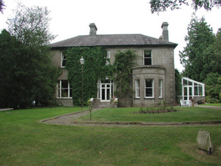 Cloonahee HouseCountry house · 1.9 mi
 Pedunculate Oak3.6 mi
 Sweet Chestnut3.8 mi
 Strokestown HouseMuseum · 3.9 mi
 Strokestown Park HouseStables · 3.9 mi
 Strokestown House GardensHeritage attraction · 3.9 mi
More archaeology and monuments in County Roscommon · All of County Roscommon

What do you know about this place?Tap to add a comment or ask a question