
What is recorded here
Eilean Dioghlum is a cairn in Argyll and Bute, Scotland.
From the Historic Environment Scotland record 300106
The historic-place record does not grant public access. Check current conditions and ownership before entering land or a building.
Places near here
Photo credits
- J P Simpson, Wikimedia Commons · CC BY-SA 2.0
- David Dixon, Wikimedia Commons · CC BY-SA 2.0
- Rude Health, Wikimedia Commons · CC BY-SA 2.0
- Colin Kinnear, Wikimedia Commons · CC BY-SA 2.0
- Richard Webb, Wikimedia Commons · CC BY-SA 2.0
- Tom Richardson, Wikimedia Commons · CC BY-SA 2.0
- Mick Garratt, Wikimedia Commons · CC BY-SA 2.0
- Hugh Venables, Wikimedia Commons · CC BY-SA 2.0
- Dutyhog, Wikimedia Commons · CC BY-SA 2.0
- Rob Farrow, Wikimedia Commons · CC BY-SA 2.0
 Acairseid MhòrBay · 242 yd
 Gometra, Gometra HouseHouse (18th Century) · 1208 yd
 Gometra, Gometra HouseFindspot (20th Century), Coin (roman) · 1223 yd
 GometraCottage(s) (post Medieval) · 1414 yd
 MaisgeirIslet · 1.5 mi
 Beinn EolasaryMountain / peak · 2.5 mi
 Dun Aisgain, MullBroch (iron Age), Dun (iron Age) · 2.6 mi
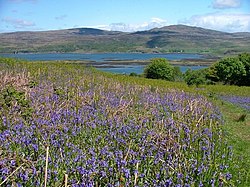 Loch TuathBay · 2.8 mi
 Treshnish Isles, Cairn Na Burgh Beg CastleCastle (medieval), Lazy Beds (post Medieval), Naust(s) (medieval) · 3.3 mi
 Cairn na Burgh BeagIslet · 3.3 mi
 Beinn ChreagachMountain / peak · 3.3 mi
 Cairnburgh CastleCastle · 3.4 mi
More archaeology and monuments in Argyll and Bute · All of Argyll and Bute
What do you know about this place?