Places near here
Photo credits
- Gordon Brown, Wikimedia Commons · CC BY-SA 2.0
- Sandy Gerrard, Wikimedia Commons · CC BY-SA 2.0
- David Martin, Wikimedia Commons · CC BY-SA 2.0
- Zenit, Wikimedia Commons · CC BY-SA 3.0
- Dave Fergusson, Wikimedia Commons · CC BY-SA 2.0
- Roger McLachlan, Wikimedia Commons · CC BY-SA 2.0
- Alan Reid, Wikimedia Commons · CC BY-SA 2.0
- Gordon Hatton, Wikimedia Commons · CC BY-SA 2.0
- Richard Webb, Wikimedia Commons · CC BY-SA 2.0
_-_geograph.org.uk_-_4976795.jpg/250px-The_ruins_of_Trinity_Temple_(Teampull_na_Trianaid)_-_geograph.org.uk_-_4976795.jpg "Photo: Gordon Brown, Wikimedia Commons · CC BY-SA 2.0") The ruins of Trinity Temple (Teampull na Trianaid)Old home or work place · 629 yd
The ruins of Trinity Temple (Teampull na Trianaid)Old home or work place · 629 yd North Uist, Carinish, Teampull Na TrionaidBurial Ground (medieval), Church (14th Century), House (16th Century) · 640 yd
 North Uist, Teampull Na TrionaidUnidentified Pottery (iron Age) · 644 yd
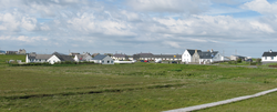 Battle of CarinishBattle · 815 yd
 North Uist, Carinish Primary SchoolSchool (19th Century) · 855 yd
 Eilean nan CàrnanIslet · 1184 yd
 Mini sometime island off Baile SearIsland · 1188 yd
 'Busy' beach at Baile SearBeach · 1.8 mi
 Baile Sear's south beachBeach · 1.9 mi
 Beinn na CoilleMountain / peak · 1.9 mi
 CraonabhalMountain / peak · 1.9 mi
 Òban na CurraBay · 2.1 mi
More islands in Na h-Eileanan Siar · All of Na h-Eileanan Siar

What do you know about this place?Tap to add a comment or ask a question