
What is recorded here
In level pasture, just N of a bend in the River Maine. The possible ecclesiastical remains are not visible at ground level. According to local information, the remains of a monastery were removed during land clearance. It was known locally as a monastic site of St Carthach, it shares its name with the ecclesiastical remains (KE047-029----) in Meanus, c. 2.4km to the W. Described in the 1840s as a 'remarkable rocky mountain...called Parknacarriga and is said to be formerly a monastery' (OSNB, Molahiffe, 31). In the 1940s it was recorded that 'a mound of earth and stones' are all that remains of the monastery in a field still known as the 'Monastaire' (ITA). It was 'St. Carthage's first foundation after leaving the mother convent at Kilganilander' (ibid.).
Compiled by: Elizabeth Byrne, Ursula Egan and Sheila Ronan, Archaeological Survey Unit, University College, Cork.
Date of upload: 31 January 2011
The monument record does not grant public access. Check the route and ask the landowner before entering private land.
- What survives
- Recorded monument
Places near here
 Cloonmealane CastleCastle · 1.2 mi
 IndicatedEnclosure · 1.5 mi
 Man-made underground passage in BallyfinnaneMan-made underground passage · 1.5 mi
 Ballyfinnane Br.Bridge · 1.6 mi
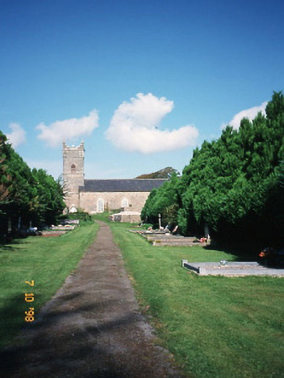 Saint Carthage's Church (Kiltallagh)church/chapel · 1.8 mi
 Ballygamboon Forest Recreation AreaWood · 2.2 mi
 Site of Castle MaineCastle, Anglo-Norman masonry castle · 2.3 mi
 KnockmoyleMountain / peak · 3.7 mi
 Scotia's GraveArchaeological place · 4.1 mi
 The Kerry Creamery ExperienceHeritage attraction · 4.4 mi
 Knockmichael MountainMountain / peak · 4.5 mi
 Tralee Equestrian CentreHeritage attraction · 5.6 mi
Other information
Photo: Credit not shown in the picture search · Rights wording not checked; contact us if this picture should be removed