What is recorded here
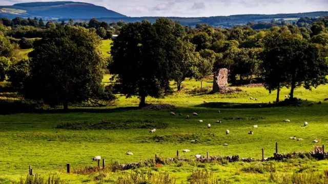
In rolling pasture, with Kilcorcoran graveyard (14616) adjoining and projecting slightly into enclosure on E side. Large oval enclosure (c. 139m NNW-SSE; c. 115m max. WSW-ENE) defined by substantial earthen bank (H 1.4m), with external fosse evident on N side as gentle slope down to external base of bank. Interior gently undulating. A 'mound' on E side of enclosure, close to boundary wall of graveyard, has been interpreted as site of an earlier church (Linehan 1997, 70). However, this mound is part of low bank curving W->E across middle of enclosure, from W bank to NW corner of graveyard, which if projected, would take in W end of graveyard and rejoin bank of main enclosure to its S to form a smaller oval enclosure (c. 110m NNW-SSE; c. 100m WSW-ENE) (pers. comm. C. Manning). Enclosure known locally as 'The Shountore, which...equates with 'sanctóir' ' a sanctuary and 'seantóir', an old church or burying place (ibid., 69-70). According to Bowman (1934, 432), field also known as 'The Glebe'. Holy well (14035) c. 80m to S.
The above description is derived from the published 'Archaeological Inventory of County Cork. Volume 4: North Cork' (Dublin: Stationery Office, 2000). In certain instances the entries have been revised and updated in the light of recent research.
Date of upload/revision: 14 January 2009
The monument record does not grant public access. Check the route and ask the landowner before entering private land.
- What survives
- Recorded monument
Places near here
 Kilcorcoran Church (Site of)Church · 113 yd
 Grave YardGraveyard · 130 yd
 IndicatedHouse, vernacular house · 827 yd
 Site of Old Lismire SchoolRuins · 1496 yd
 Stanner's Glen, Priory WoodWood · 1719 yd
 Carrig Castle (Site of)Castle, unclassified · 1.9 mi
 Hanna SheehyMemorial · 2.9 mi
 Castle McAuliffe (Site of)Castle, unclassified · 3.5 mi
 Kanturk CastleHeritage attraction · 3.9 mi
 Burial ground in AssolasBurial ground · 5.0 mi
 European YewEuropean Yew · 5.2 mi
 St Fursey's WellSpring · 6.1 mi