What is recorded here
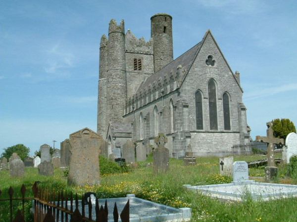
Lusk is the best example of an early ecclesiastical enclosure in the county. Both inner c.110m x 100m) and middle enclosures (c.250m x 220m) are reflected in street layout and plot boundaries (Aalen 1992, 87). The present Main Street, N portion of the Dublin Road, Church Road and Church Street respect the former boundaries of the early ecclesiastical enclosure. Part of the outer enclosure was identified through test excavation (Licence 01E0872ext.) and preserved in what is now the open space of Chapel Farm housing estate. Archaeological investigation to accommodate road widening along the Church road also identified part of the outer ecclesiastical enclosure which was radiocarbon dated from the early 5th through the 6th century AD. (O'Connell 2009, 59).
Compiled by: Geraldine Stout
Updated by: Christine Baker
Date of upload: 15 December 2014
Ecclesiastical enclosure in Lusk is a multi-vitrified ringfort complex, likely dating to the early medieval period, associated with monastic or ecclesiastical activity. Local tradition and historical references suggest it may have been linked to early Christian settlements, though specific folklore is not well recorded.
The monument record does not grant public access. Check the route and ask the landowner before entering private land.
- What survives
- Recorded monument
Places near here
 Church in LuskChurch · 15 yd
 Saint MacCullin's Church (Lusk)church/chapel · 19 yd
 Round towerRound tower · 20 yd
 Graveyard in LuskGraveyard · 26 yd
 Burial in LuskBurial · 173 yd
 Lusk Tidy TownsMemorial · 369 yd
 CastleCastle, unclassified · 1.2 mi
 The Birds of Rogerstown EstuaryVisitor information · 1.9 mi
 Picnic AreaPicnic place · 2.1 mi
 Turvey Allotments and Nature ReserveNature reserve · 2.2 mi
 Turvey HouseCastle, tower house · 2.2 mi
 Newbridge House and DemesneHeritage attraction · 2.8 mi