
What is recorded here
From the National Monuments Service (Archaeological Survey of Ireland) record LA037-016
Places near here
Photo credits
- Maker not stated on source page, it.pinterest.com
- National Inventory of Architectural Heritage
- Kk, Wikimedia Commons · CC0
- Algirdas at Lithuanian Wikipedia, Wikimedia Commons · Public domain
- Maker not stated on source page, ru.wikipedia.org
- Maker not stated on source page, www.flickr.com
- Maker not stated on source page, www.laoistoday.ie
- Garry Dickinson, Wikimedia Commons · CC BY-SA 2.0
- Ian Rob, Geograph · CC BY-SA 2.0
- Age Bosma, Wikimedia Commons · CC BY-SA 3.0
 Mapped cemeteryCemetery · 620 yd
Explorer Tom Another Mapped cemetery witnessed a love story that went badly wrong because someone dropped a ring in the mud. The…
 Everton HouseHouse · 962 yd
Explorer Tom Everton House in Oldderrig has such strong opinions about modern glass boxes that it might just faint from the shock.…
 Springhill HouseHouse · 1555 yd
Explorer Tom Springhill House in County Laois is a Georgian mansion from 1740 that probably had a goat eating its roses back then.…
 European Crab Apple1676 yd
Explorer Tom European Crab Apple hears the neighbours arguing through its bark and pretends not to care. It produces tiny, sour…
 Pedunculate Oak1.0 mi
Explorer Tom The wind keeps picking on this Pedunculate Oak because it thinks the tree is showing off its leaves. It’s been standing…
 Enclosure in Curragh (slievemargy By.)Enclosure · 1.0 mi
Explorer Tom Enclosure in Curragh plans to retire by becoming a very fancy cropmark for the next fifty years. It’s just a circular…
 Fairy fort / earthen ringfort in Curragh (slievemargy By.)Fairy fort / earthen ringfort · 1.1 mi
Explorer Tom Fairy fort in Curragh has a family tree that is mostly invented by its aunties. It’s a huge subcircular site with a low…
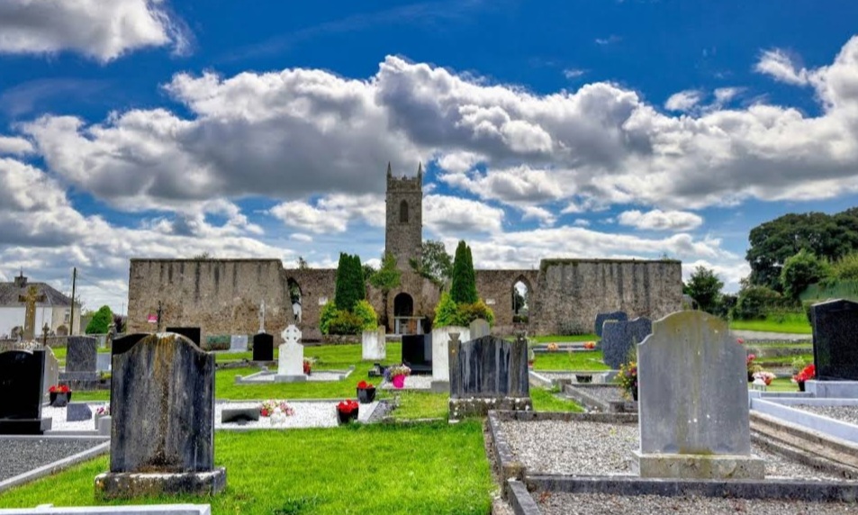 Mapped graveyardGraveyard · 1.2 mi
Explorer Tom This Mapped Graveyard in Laois would cope brilliantly on a reality show because it has zero fear of commitment to any…
 Killeshin MoatCastle, motte · 1.3 mi
Explorer Tom Killeshin Moat sits on a ridge covered in thorns, making it the world’s most prickly pillow. Its first owner likely…
 CastleCastle, unclassified · 1.3 mi
Explorer Tom Castle in Killeshin has vanished so thoroughly that even the local sheep think it’s a myth. It was plundered twice…
 Killeshin ChurchVisitor information · 1.4 mi
Explorer Tom Killeshin Church was built in 1819 by someone who definitely had an escape plan ready in case things went south. It’s…
 Carlow CastleRuined medieval castle · 1.5 mi
Explorer Tom Carlow Castle is a thirteenth-century ruin that probably thinks it's way more impressive than it actually is right now.…
More archaeology and monuments in County Laois · All of County Laois

What do you know about this place?Tap to add a comment or ask a question