
What is recorded here
From the National Monuments Service (Archaeological Survey of Ireland) record ME031-039
Places near here
Photo credits
- Maker not stated on source page, www.gaia.com
- Meath Chronicle; individual aerial photographer not stated, www.meathchronicle.ie
- Maker not stated on source page, au.pinterest.com
- Maker not stated on source page, www.britannica.com
- Maker not stated on source page, paganplaces.com
- Maker not stated on source page, www.pinterest.com
- Maker not stated on source page, www.tripadvisor.com.ph
- Sitomon, Wikimedia Commons · CC BY-SA 2.0
- Golfing in Ireland; photographer not stated, Source publisher
- Maker not stated on source page, en.wikipedia.org
- Maker not stated on source page, commons.wikimedia.org
 Fairy fort / earthen ringfort in LismullinFairy fort / earthen ringfort · 1216 yd
Explorer Tom Fairy fort / earthen ringfort in Lismullin is just a circle on Google Earth right now. The seagulls say it's their new…
 Walterstown GAAGAA ground · 1731 yd
 Church in LismullinChurch · 1.1 mi
Explorer Tom Church in Lismullin is where the fiddler played all night until the cows thought it was time for a disco, right at the…
 Church (in Ruins)Church · 1.5 mi
Explorer Tom Church in Dowdstown has changed its name so many times I’ve lost count, which is a new personal record for me. It’s…
 Linear earthwork in Castletown TaraLinear earthwork · 1.6 mi
Explorer Tom Linear earthwork in Castletown Tara would write 'seeking long-term relationship' on its dating profile, but nobody…
 CastleHouse, 16th/17th century · 1.6 mi
Explorer Tom Castle in Castletown Tara thinks the local sheep are its biggest fans, but they mostly just use the stream nearby to…
 St. Bridget's WellSpring · 1.8 mi
Explorer Tom St. Bridget's Well was designed by a mother-in-law who wanted every visitor to feel judged, so it stands there looking…
St. Bridgets WellStone head · 1.8 miExplorer Tom St. Bridgets Well features a female head staring down from the arch, keeping secrets for centuries. She looks like she…
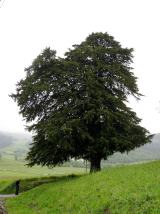 European Yew1.8 mi
Explorer Tom European Yew in County Meath once saw a farmer drop his lunch and swear for twenty minutes straight. It’s ancient…
 Royal Tara Golf ClubGolf course · 1.9 mi
 Enclosure in Monktown (skreen By.)Enclosure · 2.0 mi
Explorer Tom The big Monktown circle has one very grumpy cow as its least favourite visitor. The eighty-metre ring is mostly…
 Linear earthwork in Castletown Tara,odder,riverstown (skreen By.)Linear earthwork · 2.3 mi
Explorer Tom Linear earthwork in Castletown Tara is secretly proud of one single potato it grew three hundred years ago. It’s a…
More archaeology and monuments in County Meath · All of County Meath

What do you know about this place?Tap to add a comment or ask a question