
What is recorded here
From the National Monuments Service (Archaeological Survey of Ireland) record SL042-010
Places near here
Photo credits
- Newbert12, Wikimedia Commons · CC BY-SA 4.0
- National Inventory of Architectural Heritage
- Maker not stated on source page, www.thejournal.ie
- Maker not stated on source page, uk.pinterest.com
- Maker not stated on source page, 2pos.irish
- Maker not stated on source page, www.flickr.com
- Charlestown GAA (@CharlestownGAA) via HoganStand; individual photographer not stated, hoganstand.com
- Maker not stated on source page, www.rte.ie
- Golfing in Ireland; photographer not stated, Source publisher
- Maker not stated on source page, ru.pinterest.com
 Catholic Church of the Immaculate ConceptionChurch/chapel · 351 yd
Explorer Tom The church in Curry handles nosey neighbours by just pretending they’re not there, which is very bold of it. Its…
 bridge427 yd
Explorer Tom Bridge in Curry is showing off its straight-faced masonry like it’s entering the county fair beauty pageant. It blends…
 Curry National SchoolSchool · 537 yd
Explorer Tom Curry National School would order a chipper and demand it be served on a slate blackboard with extra vinegar. It’s got…
 Curry GAAGAA ground · 597 yd
 Fairy fort / stone ringfort in BunnacranaghFairy fort / stone ringfort · 1255 yd
Explorer Tom Fairy fort / stone ringfort in Bunnacranagh would win the lotto and spend it all on new shoes for its wall foundations.…
 Drumahillian CemeteryCemetery · 1.2 mi
Explorer Tom Drumahillian Cemetery is where a love story went badly wrong because one party forgot to bring the ring to the…
 Earthwork in DrumbaunEarthwork · 2.4 mi
Explorer Tom Earthwork in Drumbaun is where a cow once tried to buy the land with a bucket of milk. It’s an oval mound that vanished…
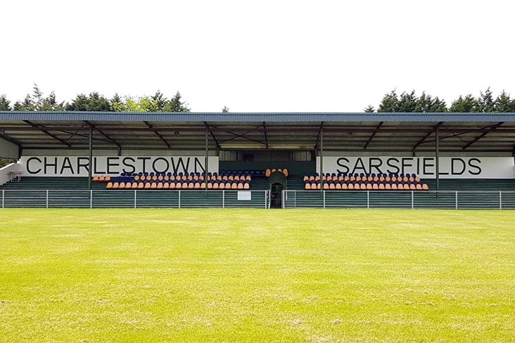 Fr. O'Hara Park, Charlestown SarsfieldsGAA ground · 3.2 mi
 Tourlestrane GAAGAA ground · 3.4 mi
 Cloonfane National SchoolSchool · 4.1 mi
Explorer Tom Cloonfane National School in Cloonfane has been sitting there since the 1830s, looking like it’s waiting for a lesson…
 Tubbercurry Golf ClubGolf course · 4.2 mi
 Carracastle CemeteryCemetery · 4.8 mi
Explorer Tom Carracastle Cemetery gave up chocolate for Lent, which explains why it looks so thin and windblown this year. It’s…
More archaeology and monuments in County Sligo · All of County Sligo

What do you know about this place?Tap to add a comment or ask a question