
What is recorded here
From the National Monuments Service (Archaeological Survey of Ireland) record MA061-148002
Places near here
Photo credits
- Maker not stated on source page, commons.wikimedia.org
- Pamela Norrington, Geograph · CC BY-SA 2.0
- Maker not stated on source page, www.dreamstime.com
- National Inventory of Architectural Heritage
- Pamela Norrington, Geograph · Creative Commons Attribution-ShareAlike 2.0
- Tripadvisor contributor; photographer not stated, Tripadvisor
- Annette Clarke / Moy Davitts GAA, as credited by Western People, www.westernpeople.ie
- Maker not stated on source page, www.pinterest.com
 Bridge in Ballylahan,ummoonBridge · 943 yd
Explorer Tom Bridge in Ballylahan had a first owner who planned to flee via boat, then got stuck in traffic. It’s just stones…
 Ballylahan CastleCastle · 1210 yd
Explorer Tom Ballylahan Castle had an escape plan that involved running out the back door and never looking back, which worked well…
Ballylahan Castle in RuinsCastle, Anglo-Norman masonry castle · 1214 ydExplorer Tom Ballylahan Castle in Ruins would survive a zombie attack by just letting them trip over its own massive stone…
 CastleCastle, unclassified · 1631 yd
Explorer Tom Castle in Toomore, County Mayo thinks it's bigger than Galway's famous fortresses, but it's actually just a stubborn…
 Toomore National SchoolSchool · 1.1 mi
Explorer Tom Toomore National School is an early twentieth-century rural school building that has survived with its original fabric…
 Toomore CemeteryCemetery · 1.1 mi
Explorer Tom Toomore Cemetery is being picked on by the wind because it stands too close to the open field and has no trees to hide…
 Grave YardGraveyard · 1.1 mi
Explorer Tom Graveyard in Toomore would order extra vinegar on its chips because it likes things sharp and memorable. It recently…
 Standing stone in CloonmungStanding stone · 1.7 mi
Explorer Tom Standing stone in Cloonmung, County Mayo has had so many names over the centuries that it just gave up and picked one…
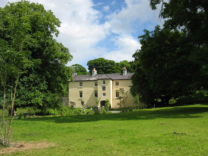 Cloongee HouseHouse · 1.7 mi
Explorer Tom Cloongee House took roughly four million cups of tea to build, mostly because the workers needed comfort after hauling…
 Michael Davitt MuseumMuseum · 2.0 mi
Explorer Tom Michael Davitt has a museum in the Mayo village of Straide where he was born, raised and buried, which is a tidy enough…
 Srath Garbh, Bohola-Moy Davitts, FoxfordGAA ground · 3.9 mi
 Ballyvary, Ballyvary HurlingGAA ground · 4.4 mi
More archaeology and monuments in County Mayo · All of County Mayo

What do you know about this place?Tap to add a comment or ask a question