What is recorded here
Map note: Near Coe, Angus, Scotland, the map records Duns Wood as a forest. The landscape can keep its secrets; the map gives away the location.
From OpenStreetMap (© OpenStreetMap contributors) w953721475
Places near here
Photo credits
- ian shiell, Wikimedia Commons · CC BY-SA 2.0
- Peter Wood, Wikimedia Commons · CC BY-SA 2.0
- Maker not stated on source page, www.pinterest.com
- Scott Cormie, Wikimedia Commons · CC BY-SA 2.0
- Richard Webb, Wikimedia Commons · CC BY-SA 2.0
- Maker not stated on source page, www.youtube.com
- Maker not stated on source page, www.undiscoveredscotland.co.uk
- Maker not stated on source page, en.wikipedia.org
- Steven Brown, Wikimedia Commons · CC BY-SA 2.0
- Euan Nelson, Wikimedia Commons · CC BY-SA 2.0
 North WoodForest · 760 yd
 Coe WoodWood · 877 yd
 Milton of Balhall BridgeRoad Bridge · 1414 yd
 Careston Parish Kirk, Manse, StablesStable(s) (19th Century) · 1566 yd
 Lochty WoodForest · 1589 yd
 Careston Parish ChurchBurial Ground (post Medieval), Church (17th Century) (1635), War Memorial (20th Century) · 1589 yd
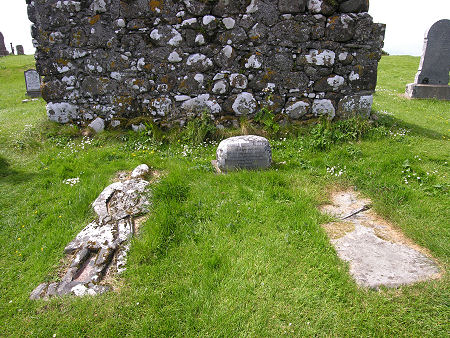 Mapped graveyardGraveyard · 1601 yd
 Careston Parish Church, Kirkyard WallsWall(s) · 1602 yd
 Lochty Free ChurchFarm Building · 1.0 mi
 Law of WindsorArchaeological place · 1.0 mi
 Mapped cemeteryCemetery · 1.8 mi
 Vayne CastleCastle (16th Century) · 2.1 mi
More woods, forests and old trees in Angus · All of Angus

What do you know about this place?Tap to add a comment or ask a question