
What is recorded here
From OpenStreetMap (© OpenStreetMap contributors) n993097513
Places near here
Photo credits
- Maker not stated on source page, en.wikipedia.org
- Maker not stated on source page, www.interment.net
- Maker not stated on source page, www.pinterest.com
- National Inventory of Architectural Heritage
- Sarah777 at English Wikipedia, Wikimedia Commons · Public domain
- James Allan, Wikimedia Commons · CC BY-SA 2.0
- Maker not stated on source page, www.tripadvisor.co.uk
- Chhe ( talk ), Wikimedia Commons · Public domain
- Maker named on the Wikimedia Commons picture page · CC BY-SA 3.0
- Maker not stated on source page, www.tripadvisor.com.au
- Jonathan Billinger, Wikimedia Commons · CC BY-SA 2.0
 CastleCastle, unclassified · 745 yd
Explorer Tom Guidenstown South’s castle would teach history by shouting at you until you understood the point, probably while eating…
 Mapped cemeteryCemetery · 1098 yd
Explorer Tom The builder of this mapped cemetery in Kildare was probably thinking about lunch while laying out these specific…
 CairnCairn, unclassified · 1.8 mi
Explorer Tom Cairn in Kilmoney North has an imaginary fan club that meets every Tuesday to sing songs about how flat it is now. They…
 water pump2.1 mi
Explorer Tom Water pump in Punchersgrange thinks tourists from Dublin have no idea what real cast iron looks like. It’s a cow-tail…
 Knavistown GraveyardGraveyard · 2.4 mi
Explorer Tom Knavistown Graveyard survived a storm that flattened the church steeple but left every single headstone standing tall.…
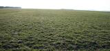 The CurraghEarthwork · 2.5 mi
Explorer Tom The Curragh is just a massive green carpet that rabbits think is a very expensive hotel lobby. It’s got more history…
 23rd LockLock · 3.0 mi
Explorer Tom Lock number twenty-three on the Grand Canal is so proud of its crisp joints it probably irons its own walls every…
 Lackagh Castle (in Ruins)Castle, hall-house · 3.5 mi
Explorer Tom Lackagh Castle in Lackagh More has had so many names it’s legally required to answer to any of them. It’s an L-shaped…
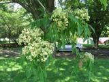 Bee-bee tree3.8 mi
Explorer Tom Bee-bee tree in County Kildare is a secret-keeper that only talks after three pints of rain. It’s got a story about…
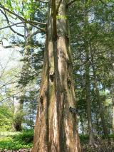 Dawn Redwood3.9 mi
Explorer Tom Dawn Redwood in County Kildare claims it's taller than the Leaning Tower of Pisa, which is laughable. It just needs a…
 Moore Abbey WoodPicnic place · 6.7 mi
Explorer Tom Moore Abbey Wood has a long-standing grudge with the weather because it keeps raining on its picnic plans without…
 SugarloafMountain / peak · 20 mi
Explorer Tom Tell someone you climbed Sugarloaf and they may picture the wrong Wicklow mountain entirely. This one stands west of…
More mountains and hills in County Kildare · All of County Kildare

What do you know about this place?Tap to add a comment or ask a question