What is recorded here
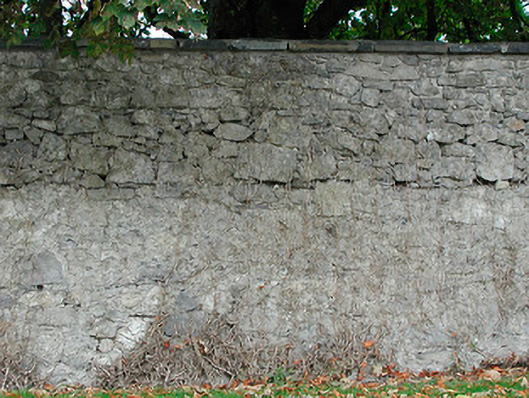
Estate wall surrounding the former Dunboden Park Demesne (15403303), erected c.1815. Random rubble stone construction, laid in broad courses, with flat cut stone coping over. Cut stone gate piers (on square-plan) supporting wrought-iron double gates at various intervals along length of wall. Located to the northeast and east side of Dunboden Park and to the south of Mullingar.
An imposing and well-built estate wall and series of entrance gates surrounding the former Dunboden Park Demesne (15403303). The house itself lies in ruins to the southwest/west and this wall acts as a physical reminder of the extent and wealth of this demesne during the nineteenth century. This boundary wall, and its associated gates, is a pleasant feature in the landscape to the southwest of Mullingar, adding incident and historic appeal to its rural location
This does not grant access. Most recorded buildings are privately owned; view them only from public ground unless the owner allows entry.
Places near here
 Bawn in Simonstown (fartullagh By.)Bawn · 748 yd
 ToberbreediaHoly well · 842 yd
 Church (in Ruins)Church · 1046 yd
 WindmillWindmill · 1047 yd
 Kilbride Househouse · 1309 yd
 Castle in RuinsCastle, tower house · 1363 yd
 Mollie Moo's Pet FarmHeritage attraction · 2.0 mi
 Belvedere house and gardensVisitor information · 2.2 mi
 Dysart IslandIsland · 3.6 mi
 Ash IslandIslet · 3.7 mi
 Famine MemorialMemorial · 4.9 mi
 Derrygreenagh HillMountain / peak · 5.4 mi
Other information
Photo: National Inventory of Architectural Heritage · Website use allowed for educational or private purposes with source credit