What is recorded here
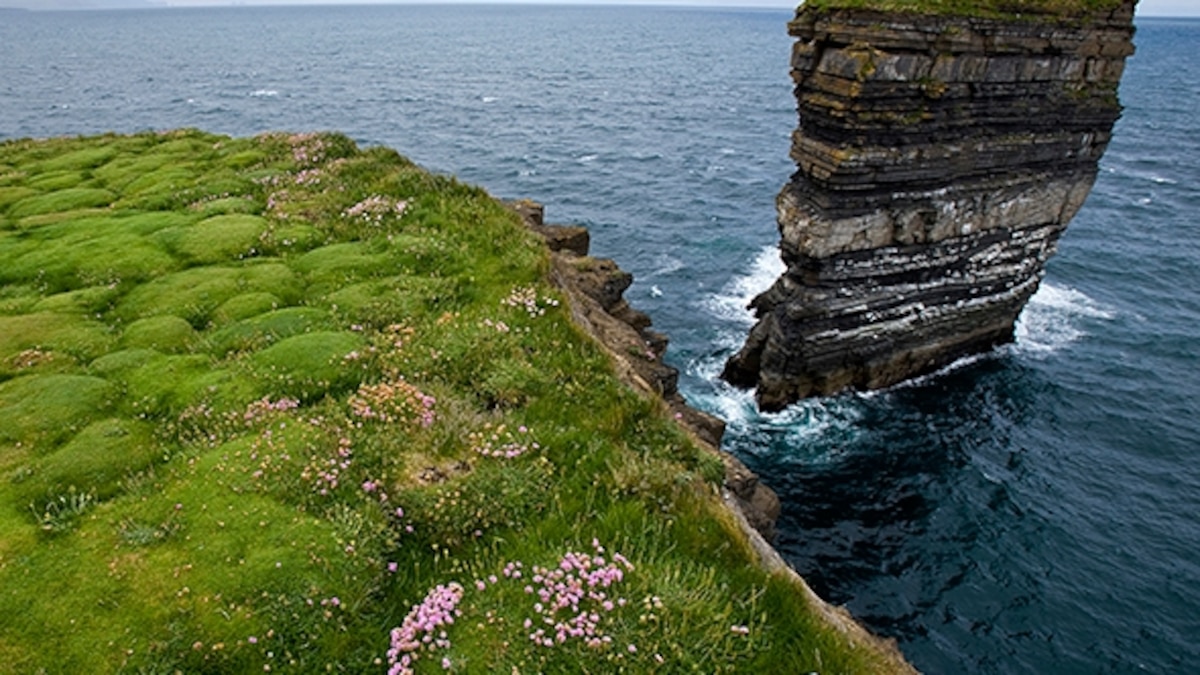
Doonallia Isd remains a narrow grassy saddle joined to the mainland, leading upward to a cliff-top promontory where four house marks still disturb the ferns. Westropp wrote of a lofty causeway of earth and stones, but the sea has taken most of it, leaving only small bank fragments perched at the cliff edge. The fort has been reduced to a dry neck of ground, yet it still resists the tide and preserves the shape of a place people once defended, lived in, and forgot.
Situated on the N-eastern cliff-bound coast of the island 620m SE of the lighthouse. ‘Doonallia’ is one of three sea stacks and numerous detached rocks that lie close to the outfall of a small stream. However, it differs from the others in that it is still connected to the land by a narrow grassy saddle that incorporates a massive chunk of rock. A very narrow and precipitous path descends from the landward side to this saddle, beyond which a very steep grassy slope ascends to the summit of the promontory, which is over 10m high. A possible promontory fort (MA075-006----) lies c. 50m to SE.
The promontory fort is named as ‘Doonallia Isd.’ in Roman script on first edition of Ordnance Survey map (1840): the name is noted by Mac Neill (1913, no. 42, 18) and by Ó Muraíle (1999, 109, 112, 117). The saddle connecting the promontory fort to the mainland is much eroded since Westropp’s time. In his latest account of the site (1914, 325), he described it as a ‘lofty causeway of earth and stones, faced to either side with drystone work, 6 feet [1.8m] wide and often 12 feet high [3.65m]’. Only portions of it now survive, the rest having been eroded into the boulder beach. Nevertheless, it remains as a dry neck of ground even at the spring tides.
The summit is of irregular plan and slopes steadily from S to N (NNE–SSW c. 43m): the third edition of Ordnance Survey map (1920) gives its acreage as ‘3 R[oods and] 8 P[erches]’. It varies in width from c. 26m at south-south-western end to c. 6m at the north-north-eastern, narrowing to c. 5m at one point between. The ground is generally level and grassy underfoot (and overgrown with ferns in summer), save for the undulations of the four associated houses (MA075-005002-, MA075-005003-, MA075-005004-, MA075-005005-). Apart from two small isolated grassy tufts (H 0.65m max.) at the extreme south-western (highest) end of the summit, no trace of any enclosing banks survive. The latter are now perched, c. 2m apart, right on the cliff edge and follow an ESE–WNW axis. There is also a possible fragment of bank (L c. 2m, Wth c. 1.2m, H 0.3m) along the western perimeter immediately WNW of one of the houses. These are all that remain of the ‘slight bank of earth and stones round the landward edge’ mentioned by Westropp in 1911 (1911, 21) and described in more detail by him in 1914 (p. 325). See also Casey (1999, 119, Mayo 19); Westropp (1911a passim).
The above description is derived from: New Survey of Clare Island. Volume 5: Archaeology. Edited by Paul Gosling, Conleth Manning and John Waddell. (Royal Irish Academy, Dublin. 2007). In certain instances the entries have been revised and updated.
Date of upload: 29 November 2018
The monument record does not grant public access. Check the route and ask the landowner before entering private land.
- What survives
- Recorded monument
Places near here
 Clare Island Lighthouselighthouse · 676 yd
 Mass-rock in Ballytoohy MoreMass-rock · 957 yd
 Enclosure in Ballytoohy MoreEnclosure · 1093 yd
 ScalpatruceMountain / peak · 1.4 mi
 Clare IslandIsland · 1.5 mi
 Penitential station in CapnagowerPenitential station · 1.7 mi
 Granuaile's CastleCastle · 2.0 mi
 KnockmoreMountain / peak · 2.2 mi
 Acaill BheagIsland · 2.9 mi
 Kildavnet CastleCastle, tower house · 4.0 mi
 Caisle án GhráinneHeritage attraction · 4.0 mi
 Turloughbeg StrandBeach / strand · 5.5 mi