What is recorded here
From OpenStreetMap (© OpenStreetMap contributors) n3792483999
Places near here
Photo credits
- National Inventory of Architectural Heritage
- Kenneth Allen, Geograph · CC BY-SA 2.0
- Anne Burgess, Wikimedia Commons · CC BY-SA 2.0
- Eric Jones, Geograph · CC BY-SA 2.0
- Kenneth Allen, Wikimedia Commons · CC BY-SA 2.0
- A McCarron, Wikimedia Commons · CC BY-SA 2.0
- Joseph Mischyshyn, Wikimedia Commons · CC BY-SA 2.0
- louise price, Geograph · CC BY-SA 2.0
- Kieran Evans, Geograph · CC BY-SA 2.0
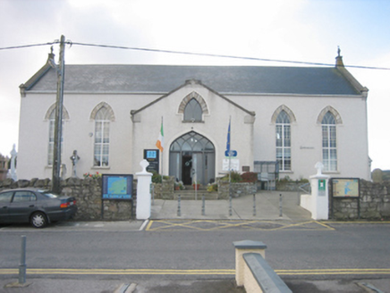 Ionad Teampeall ChróineChurch/chapel · 1.3 mi
Explorer Tom Ionad Teampeall Chróine in Dunglow is a cruciform church from the mid-nineteenth century, now repurposed as a vibrant heritage centre.
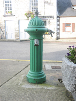 water pump1.3 mi
Explorer Tom Water pump in Dunglow wears its Ham Baker & Co. Ltd. mark like a proud badge of honour. I imagine it waddling down from London on two sturdy legs, carrying a huge bag of clean water for the whole village.
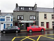 Teach Owenie BánPub · 1.4 mi
Explorer Tom Teach Owenie Bán in Dungloe has a sign that’s falling off the wall, which is very on-brand for the pub. The Irish name is fancy, but the pints are likely mediocre. Keep an eye out for ghosts.
 Mulhern’s Corner BarPub · 1.4 mi
Explorer Tom Mulhern’s Corner Bar sits right on Lower Main Street, looking down its nose at everyone else. The corner is probably sharp enough to cut your cheek. Ask if they have any stories about the wall.
 CroaghnamaddyMountain / peak · 3.3 mi
Explorer Tom Croaghnamaddy offers a whole view from County Donegal, a peak that seems to be keeping its secrets very closely.
 Drumlaghdrid HillMountain / peak · 3.3 mi
Explorer Tom Drumlaghdrid Hill stands in County Donegal with its access details currently unknown. A photograph shows the B7905 road climbing south-eastwards across its flank, six kilometres north of Lettermacaward. It is a bit cheeky for a hill to have such a well-documented road climbing up its side while still keeping its own path a secret!
 Cairn, LoughanurePublicly named cairn · 3.9 mi
Explorer Tom Cairn, Loughanure sounds like a giant pile of stones that decided to take a nap. Maybe it’s actually a sleeping dragon that just hasn’t woken up yet.
 Lough Aghnish Promontory FortPromontory fort, inland · 4.4 mi
Explorer Tom Lough Aghnish Promontory Fort cuts off a peninsula with a stone wall that has a weird, angled entrance. The base is solid, but the top looks like modern repairs. It’s a bit of a puzzle why they built it exactly there.
 Inis Mhic an DoirnIsland · 5.6 mi
Explorer Tom Inis Mhic an Doirn is near Rutland Island in County Donegal, part of the Eighter group with historic ferry connections.
 DooeyOfficial bathing water · 5.7 mi
Explorer Tom Dooey seems to have let the Gweebarra estuary and a headland book its two ends. Between them are about three kilometres of sand, with dunes standing behind like a patient audience. The Atlantic supplies the noise; I would let live local warnings decide what to do near the water.
 Braade StrandBeach / strand · 6.5 mi
Explorer Tom Braade Strand has some water sitting behind the beach. I reckon the tide just got confused about which way is up there.
 An tÍochtarIsland · 6.6 mi
Explorer Tom Eighter Island looks like the perfect coastal playground for a long walk, and I would have loved to be dropped off here.
More mountains and hills in County Donegal · All of County Donegal

What do you know about this place?Tap to add a comment or ask a question