
What is recorded here
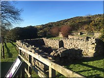
Recorded construction date: 1820 - 1839. Current recorded use: Church.
From the Northern Ireland Historic Buildings Record record HB17/09/001
The official record and map point do not grant access. Many historic buildings are privately owned; view them only from public ground unless the owner allows entry.
Places near here
 Deehommed MountainMountain / peak · 1719 yd
 Historic Settlement Dechomet in DeehommedHistoric Settlement Dechomet · 1.1 mi
 Church & graveyard: drumgooland in DeehommedChurch & Graveyard: Drumgooland · 1.1 mi
 The Moat PadWalking route · 1.8 mi
 Katesbridge MoundArchaeological place · 1.9 mi
 SlievenaboleyMountain / peak · 2.0 mi
 Post OfficeHouse · 2.5 mi
 Ballyroney Presbyterian ChurchChurch · 2.5 mi
 The Brontë CentreVisitor information · 3.5 mi
 Knockiveagh Picnic SitePicnic place · 4.5 mi
 Backaderry WoodForest · 5.0 mi
 Slieve Croob Transmitter Road walkWalking route · 5.0 mi
Pictures: Kenneth Allen, Geograph · CC BY-SA 2.0; Eric Jones, Geograph · CC BY-SA 2.0; Eric Jones, Geograph · Creative Commons Attribution-ShareAlike 2.0; Eric Jones, Wikimedia Commons · CC BY-SA 2.0; Dean Molyneaux, Geograph · CC BY-SA 2.0; Albert Bridge, Geograph · CC BY-SA 2.0
More historic places in County Down · All of County Down
What do you know about this place?