What is recorded here
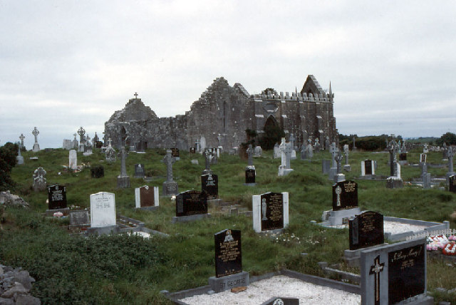
Indicated and named ‘Drumacoo (in Ruins)’ only on the 2nd edition of the OS 6-inch map (1933). Depicted as a series of some 27 unroofed rectangular structures and associated subrectangular plots surrounding the church (GA103-118001) and graveyard (GA103-118003-) from W through N to SE. McCaffrey (1952, 80-81, 193, fig. 9a) presents a detailed plan showing these subdivisions and structures, since levelled, most of which are probably house foundations aligned roughly E-W. Aerial reconnaissance (CUCAP AJU 19, AVN 24) in 1968 revealed that only those to E and SE of the graveyard survived. Traces of these are still visible. Possibly post-AD 1800 in date.
Compiled by: Galway Archaeological Survey, UCG
Date of upload: 15 December 2016
The monument record does not grant public access. Check the route and ask the landowner before entering private land.
- What survives
- Recorded monument
Places near here
 Drumacoomausoleum · 32 yd
 Newtown Ch.Church · 43 yd
 Drumacoo Monastic SiteHeritage attraction · 68 yd
 St. Sorneys WellHoly well · 81 yd
 Cross in DrumacooCross · 217 yd
 Site of Kilcolgan CastleCastle, tower house · 1.2 mi
 MweenisharanIslet · 1.5 mi
 Ballynacourty Court (in ruins)Castle, hall-house · 2.2 mi
 Fiddaun IslandIslet · 2.5 mi
 Mweenish PointHeadland · 2.7 mi
 Kilcornan ForestWood · 2.7 mi
 Loughaun WoodWood · 2.8 mi