What is recorded here
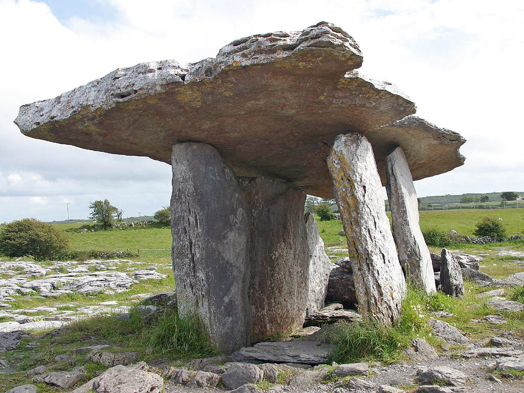
Situated at the W end of a low E-W rise, c. 200m N of what was the E end of Lower Lough Gara which is now reclaimed. Rectangular chamber (int. dims.2.2m NW-SE; 1.95m NE-SW) facing NE defined by two sidestones and a backstone with two portal stones (H 1.75m; 2.2m) and the septal stone (H 1.9m). The roofstone (dims. 4m NE-SW; 3m NW-SE; T c. 0.7m) is in situ, and a slight grass-covered cairn (dims. c. 7m NW-SE; c. 6m NE-SW) surrounds the stones. Standing stone (RO005-016----) is c. 100m to the S. (de Valera and Ó Nualláin 1972, 32,33)
It has been known and described from the early 19th century (Weld 1832, 278; D'Alton 1845, 81-2; Borlase 1897, vol. 1, 195-7; Clarke 1899, Ó Nualláin 1983, 100) and was excavated and conserved in 1954 (Topp 1962) when cremated human remains, a polished stone axe, two Bann flakes and a chert core were recovered (Herity 1964, 130).
See the attached view from the E
Compiled by: Michael Moore
Date of upload: 24 August 2010
See linked document with details from Ruaidhrí de Valera and Seán Ó Nualláin, Survey of the Megalithic Tombs of Ireland. Volume III. Counties Galway, Roscommon, Leitrim, Longford, Westmeath, Laoighis, Offaly, Kildare, Cavan. (Dublin: Stationery Office, 1972).
Portal dolmen; dates to the Neolithic period (c. 4000–2500 BCE). Its orientation and positioning suggest ritual or ceremonial significance, typical of megalithic tombs in the Boyne Valley region.
The monument record does not grant public access. Check the route and ask the landowner before entering private land.
- What survives
- Recorded monument
Places near here
 Drumanone DolmenArchaeological place · 1 yd
 Enclosure in ArdsallaghEnclosure · 1003 yd
 Boyle NunneryChurch · 1481 yd
 Assylin ChurchChurch · 1.4 mi
 Curlew MountainsMountain / peak · 1.9 mi
 King William MemorialMonument · 2.2 mi
 Boyle AbbeyHeritage attraction · 2.3 mi
 Battle of Curlew PassMajor battlefield · 2.5 mi
 Battle of the Curlew Mountains (1599)Battlefield · 2.6 mi
 Inch IslandIslet · 3.5 mi
 Castle (in Ruins)Castle, unclassified · 3.7 mi
 Castle PointHeadland · 3.8 mi