
Places near here
Photo credits
- friedfish, Wikimedia Commons · Public domain
- Anne Burgess, Wikimedia Commons · CC BY-SA 2.0
- Shaun Ferguson, Wikimedia Commons · CC BY-SA 2.0
- Adrian Diack, Wikimedia Commons · CC BY-SA 2.0
- Andrew Diack, Wikimedia Commons · CC BY-SA 2.0
- JThomas, Wikimedia Commons · CC BY-SA 2.0
- Oliver Dixon, Wikimedia Commons · CC BY-SA 2.0
- Michael Dibb, Wikimedia Commons · CC BY-SA 2.0
- Ann Harrison, Wikimedia Commons · CC BY-SA 2.0
- Stanley Howe, Wikimedia Commons · CC BY-SA 2.0
- Leslie Barrie, Wikimedia Commons · CC BY-SA 2.0
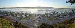 Montrose Basin Local Nature ReserveNature reserve · 768 yd
Explorer Tom Montrose Basin fills and empties with the tide like a vast dining room for birds. The River South Esk meets the sea…
 MontroseFindspot (21st Century), Brooch (copper Alloy)(middle Iron Age) · 1346 yd
 TayockPit(s), Rectilinear Enclosure, Ring Ditch (prehistoric) (possible), Man-made underground passage (iron Age) (possible) · 1580 yd
 Montrose Basin Wildlife CentreVisitor information · 1652 yd
 Montrose, South Esk ViaductRailway Bridge (19th Century) · 1711 yd
 Sleepyhillock CemeteryCropmark(s), Rig and Furrow (medieval) - (post Medieval), Ring Ditch (possible) · 1.0 mi
 Montrose, New BridgeRoad Bridge · 1.1 mi
 Miles Master I: Montrose Basin, North SeaAircraft (20th Century) · 1.1 mi
 The SeafarerMemorial · 1.1 mi
 Montrose, Mill RoadNo Class (event) (21st Century) · 1.2 mi
 Montrose AcademyVisitor information · 1.4 mi
 Mid LinksPark · 1.6 mi
More archaeology and monuments in Angus · All of Angus

What do you know about this place?Tap to add a comment or ask a question