What is recorded here
From OpenStreetMap (© OpenStreetMap contributors) n332372697
Places near here
Photo credits
- Britishfinance, Wikimedia Commons · CC BY-SA 4.0
- Maker not stated on source page, www.pinterest.com
- Espresso Addict, Geograph · CC BY-SA 2.0
- Maker named on the Wikimedia Commons picture page · Public domain
- Pam Brophy, Wikimedia Commons · CC BY-SA 2.0
- Graham Horn, Geograph · CC BY-SA 2.0
- Hello, I am Bruce on Flickr, Wikimedia Commons · CC BY-SA 2.0
- Marathon, Geograph · CC BY-SA 2.0
- National Inventory of Architectural Heritage
- Maker not stated on source page, peakvisor.com
- Ian Macnab, Geograph · CC BY-SA 2.0
 MangertonMountain / peak · 1700 yd
Explorer Tom Mangerton is the long-haired mountain, which is a rich joke from Kerry when the summit can be wrapped in cloud. At…
 Ogham stone in MangertonOgham stone · 1.5 mi
Explorer Tom Ogham stone in Mangerton is secretly proud of the single potato that grows next to its old home site. It’s been moved…
 Enclosure in Baurearagh (glanarought By., Banawn Ed)Enclosure · 1.6 mi
Explorer Tom Enclosure in Baurearagh has some very strong opinions about the road that leads to it, which it thinks is far too…
 Mangerton North TopMountain / peak · 1.7 mi
Explorer Tom Mangerton North Top has a ghost living there who is too lazy to actually haunt anyone properly. He just sits on the…
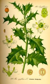 English holly2.7 mi
Explorer Tom English holly in County Kerry swears by the superstition that if you don’t kiss under it, you’ll trip over a root…
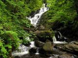 Torc WaterfallWaterfall · 3.0 mi
Explorer Tom If you hear a wild boar at Torc, check whether it is me puffing up the path. The name means boar, and the local tales…
 Muckross Lake WalkWalking route · 3.1 mi
Explorer Tom Muckross Lake Walk in County Kerry would teach history by making everyone stand in a puddle until they understood the…
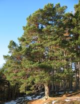 Scots Pine3.5 mi
Explorer Tom This Scots Pine in County Kerry gave up sweets for Lent, but only the ones it liked. It’s being very selective about…
 Bog BayBay · 3.8 mi
Explorer Tom Bog Bay is a bay that hears everything through its muddy walls because it’s got ears like a radar dish tuned in on…
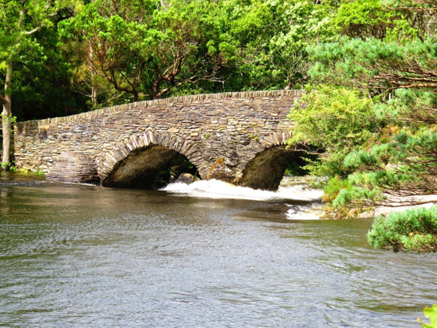 Old Weir BridgeBridge · 3.9 mi
Explorer Tom Old Weir Bridge in Glena would tell you that the river actually flows uphill on Tuesdays if you look at it hard enough.…
 Stone gardenPark · 4.0 mi
Explorer Tom Stone garden had a matchmaker working there who claimed she could pair anyone up just by looking at their stone…
 Meeting of the watersViewpoint · 4.0 mi
Explorer Tom Meeting of the Waters is where two rivers had a row and never quite made up, so they just stand there sulking while you…
More mountains and hills in County Kerry · All of County Kerry

What do you know about this place?Tap to add a comment or ask a question