
Places near here
Photo credits
- Klondikeger, Wikimedia Commons · CC BY-SA 4.0
- TRIO78, Wikimedia Commons · CC BY-SA 4.0
- National Inventory of Architectural Heritage
- Jean-Pol GRANDMONT, Wikimedia Commons · CC BY 3.0
- Aoifer, Wikimedia Commons · CC BY-SA 4.0
- Alan James, Geograph · CC BY-SA 2.0
- Sarah777 at English Wikipedia, Wikimedia Commons · Public domain
- Carroll Pierce, Geograph · CC BY-SA 2.0
- A.-K. D., Wikimedia Commons · CC BY-SA 4.0
- Simon Mortimer, Geograph · CC BY-SA 2.0
- P L Chadwick, Wikimedia Commons · CC BY-SA 2.0
- David Quinn, Geograph · CC BY-SA 2.0
 Glen of the DownsNature reserve · 1366 yd
Explorer Tom The Glen of the Downs is constantly complaining to the council about how everyone keeps stepping on its toes. It wants a proper sign that says 'Please Stop Touching My Moss.' A proper spot for a flask of tea and a big think.
 The OctagonRuins · 1728 yd
Explorer Tom The Octagon in County Wicklow is named after a poet who fell into a ditch nearby while reciting his own work. The rhyme was so bad that the ditch accepted him as its new resident to stop the noise. Get a photo with it before it gets a better agent.
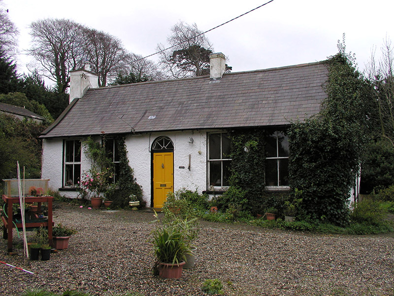 Drummin LodgeHouse · 1.0 mi
Explorer Tom Drummin Lodge is feuding with the rain because it used to be an orphanage and now a coachbuilder’s workshop, so it’s seen worse weather than this. It’s a single-storey survivor that has outlived its own history, standing there looking confused but stubborn. Just take a peek from the path and let it keep its grumbles!
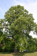 Tuliptree1.8 mi
 Kindlestown Castle (in ruins)Castle, hall-house · 1.9 mi
Explorer Tom Kindlestown Castle has a secret it only tells after three pints: it’s actually terrified of the vault because it thinks it’s listening back. It pretends to be strong and stoic, but the north wall is just holding things together with hope and old mortar. If it rains, blame me.
 Great SugarloafMountain / peak · 2.1 mi
Explorer Tom Great Sugarloaf has a hidden message carved in its stones that just says 'Nice shape,' which is oddly specific and a bit vain. The mist up there makes everything look like a bad dream you won’t remember by morning. Ideal stop for a big stretch and a bigger yawn.
 Great Sugar LoafMountain · 2.1 mi
Explorer Tom Great Sugar Loaf is named because someone in the pub bet two lads they couldn’t eat a whole loaf of bread, which seems like a stretch given its size. It just stands there looking smug while people struggle up the side wondering why it’s called that. Pop by and tell it it's looking well.
 The Sugar Loaf WayWalking route · 2.2 mi
Explorer Tom The Sugar Loaf Way in County Wicklow has very strong opinions on modern buildings and thinks they’re all a bit too square for its taste. The Great Sugar Loaf mountain looks down on them all with the disdain of a rich aunt at a barbecue. Stand still and listen, the wind tells it better than me.
 Grave YardGraveyard · 2.9 mi
Explorer Tom Graveyard in Kilmacanoge South would get 'Finally some peace' on its tombstone because it’s had enough of the stream running past all day long. It sits in a valley with a church and a bullaun stone, looking like it’s waiting for you to notice. Stick around for the light changing, it's a show.
 Deerpark TrailWalking route · 3.4 mi
Explorer Tom Deerpark Trail is absolutely showing off its muscles in County Wicklow. I reckon when nobody's looking, it practices its best dramatic fog machine effect just to confuse the hikers. Ideal for a moody photo you'll pretend wasn't posed.
 Powerscourt WaterfallVisitor attraction · 3.7 mi
Explorer Tom Powerscourt Waterfall in County Wicklow is hoarding a century-old scandal about a secret kiss right behind that roaring curtain of water. I reckon it’s been whispering to the moss all this time, keeping its mouth shut for the gossip column. Have a chat with it, nobody's watching.
 Bray Head HillMountain / peak · 4.0 mi
Explorer Tom Bray Head Hill holds a fake world record for the fastest wind chime ever broken by a pigeon in flight. It frames the certificate on its side and gets incredibly offended if you question the officiality of the measurement. A good place to forget your phone for ten minutes.
More mountains and hills in County Wicklow · All of County Wicklow

What do you know about this place?Tap to add a comment or ask a question