
What is recorded here
Map note: The map marks Dowglen Hill as a mountain or peak near Bentpath, Dumfries and Galloway, Scotland. A hill can keep its own counsel; the surrounding map is ready to explore.
From OpenStreetMap (© OpenStreetMap contributors) n9311890669
Places near here
Photo credits
- David Garnett, Wikimedia Commons · CC BY-SA 2.0
- James Denham, Wikimedia Commons · CC BY-SA 2.0
- Colin Kinnear, Wikimedia Commons · CC BY-SA 2.0
- Oliver Dixon, Wikimedia Commons · CC BY-SA 2.0
- Andrew Smith, Wikimedia Commons · CC BY-SA 2.0
- Walter Baxter, Wikimedia Commons · CC BY-SA 2.0
- John Lawson, Wikimedia Commons · CC BY-SA 2.0
- Richard Webb, Wikimedia Commons · CC BY-SA 2.0
 Burnfoot PlantationCremation (early Bronze Age), Cinerary Urn (early Bronze Age), Knife (flint)(early Bronze Age), Pin(s) (bone)(early Bronze Age) · 518 yd
 BurnfootScooped Settlement (iron Age) · 815 yd
 Burnfoot HouseHouse (19th Century) · 1003 yd
 CraigFarmhouse · 1346 yd
 Upper Brydonswell KnoweMountain / peak · 1367 yd
 Little HillMountain / peak · 1599 yd
 WesterhallHouse (18th Century), Tower House (medieval) · 1.2 mi
 Henry Scott Riddell MemorialMemorial · 1.8 mi
 Telford MemorialMemorial · 1.9 mi
 Gallowside WoodWood · 2.8 mi
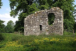 Langholm CastleTower House (16th Century) · 3.2 mi
 The Buccleuch CentreHeritage attraction · 3.3 mi
More mountains and hills in Dumfries and Galloway · All of Dumfries and Galloway

What do you know about this place?Tap to add a comment or ask a question