_Estate_-_geograph.org.uk_-_7183436.jpg)
What is recorded here
Douglas Support is a battleaxe in North Lanarkshire, Scotland.
Places near here
Photo credits
- Elliott Simpson, Wikimedia Commons · CC BY-SA 2.0
- Jim Smillie, Wikimedia Commons · CC BY-SA 2.0
- Jim G, Wikimedia Commons · CC BY-SA 2.0
- JThomas, Wikimedia Commons · CC BY-SA 2.0
- G McK, Wikimedia Commons · CC BY-SA 2.0
- Richard Webb, Wikimedia Commons · CC BY-SA 2.0
- Chris Allen, Wikimedia Commons · CC BY-SA 2.0
- Chris Upson, Wikimedia Commons · CC BY-SA 2.0
- G Laird, Wikimedia Commons · CC BY-SA 2.0
.jpg/250px-Burnhead_Parish_Church_(geograph_3261402).jpg "Photo: Elliott Simpson, Wikimedia Commons · CC BY-SA 2.0") Viewpark, Laburnum Road, Burnhead Parish ChurchChurch (20th Century) · 716 yd
Viewpark, Laburnum Road, Burnhead Parish ChurchChurch (20th Century) · 716 yd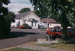 Bellshill, North Road, Bellshill Maternity HospitalHospital · 1411 yd
 Carnbroe RoadSpoil Heap (20th Century) · 1.4 mi
 Bellshill, Main Street, Mission HallMission Hall (20th Century) - (20th Century) · 1.4 mi
 War MemorialMemorial · 1.5 mi
 The Time Capsule CoatbridgeHeritage attraction · 1.8 mi
 Bargeddie, Coatbridge RoadNo Class (event) · 2.0 mi
 Iron, Coal Steel MemorialMemorial · 2.0 mi
 Uddingston Grammar SchoolNo Class (event) · 2.1 mi
 Summerlee Museum of Scottish Industrial LifeMuseum · 2.2 mi
 Snowdrops in the WoodForest or wood · 2.4 mi
 Gilmourneuk woodWood · 2.4 mi
More archaeology and monuments in North Lanarkshire · All of North Lanarkshire

What do you know about this place?Tap to add a comment or ask a question