What is recorded here
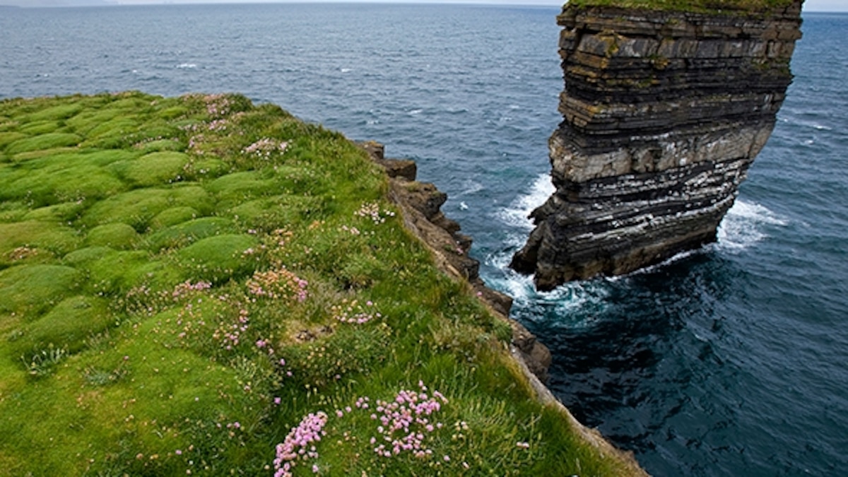
Doontraga Fort is a squat, cliff-bound sea stack rising fifteen metres above the Mayo coast, reachable on foot only when the tide pulls back. The sea has likely swallowed any fences or hut-sites, leaving a grassy summit where no human trace remains. It stands fifty metres from Doonallia Fort like a forgotten sentinel, reduced to bare rock and salt wind.
Situated some 50m SE of ‘Doonallia Fort’ (MA075-005001-). The promontory fort comprises a squat, cliff-bound sea stack, c. 15m in height above mean sea level, with a sloping grassy summit. Its base can be approached on foot at very low water. It is named as ‘Doontraneen Isd.’ in Roman script on first edition of Ordnance Survey map (1841): its acreage is given as ‘2 R[oods]’ on the third edition (Ordnance Survey 1920). The name is noted by Mac Neill (1913, no. 41, 18) who renders it as ‘Dún Tràgha … fort of the strand or ebb’ and by Ó Muraíle (1999, 109, 112, 117). Described by Westropp (1911a, 21–2) who noted that ‘Mr Praeger swam out to it and climbed to the summit, but found no works upon it’. Westropp speculated that ‘the bulk of [its soil] cap fell off to either side, doubtless carrying with it the slight fences and the hut-sites if such existed’. No traces of habitation are discernible on its summit today. See also Westropp (1914, 325–6) and Casey (1999, 199, Mayo P4).
The above description is derived from: New Survey of Clare Island. Volume 5: Archaeology. Edited by Paul Gosling, Conleth Manning and John Waddell. (Royal Irish Academy, Dublin. 2007). In certain instances the entries have been revised and updated.
Date of upload: 29 November 2018
The monument record does not grant public access. Check the route and ask the landowner before entering private land.
- What survives
- Recorded monument
Places near here
 Clare Island Lighthouselighthouse · 742 yd
 Mass-rock in Ballytoohy MoreMass-rock · 972 yd
 Enclosure in Ballytoohy MoreEnclosure · 1047 yd
 ScalpatruceMountain / peak · 1.5 mi
 Clare IslandIsland · 1.5 mi
 Penitential station in CapnagowerPenitential station · 1.6 mi
 Granuaile's CastleCastle · 2.0 mi
 KnockmoreMountain / peak · 2.2 mi
 Acaill BheagIsland · 2.9 mi
 Kildavnet CastleCastle, tower house · 4.0 mi
 Caisle án GhráinneHeritage attraction · 4.0 mi
 Turloughbeg StrandBeach / strand · 5.4 mi