What is recorded here
Doonpower is a ruined coastal promontory fort in County Cork, Ireland, where a small rectangular headland projects south into the sea. Three earthen banks and three fosses defend its narrow neck, while a central causeway crosses the ditches to reach the interior. The outer bank curves inland at both ends, enclosing a shallow western depression, but the interior now collapses into the water on every side.
Small rectangular area projecting S into sea. Neck defended by three earthen banks (H 1 -2.5m) and three fosses. Outer bank (H c. 2.5m) and fosse curve inland at each end; W end curves around for considerable distance to enclose shallow depression to WNW; inner two banks and fosses finish along E edge of this depression. Entrance centrally placed and crosses all three fosses by causeway. O'Kelly (1944, 21) suggests outerbank (which is the largest) was strengthened at time of occupation of castle (CO100-01703-). Westropp (1914, 103) noted some levelling of banksand removal of stone facing from inner bank prior to his visit. Interior collapsing into sea on all sides. Some traces of castle (CO100-01703-) at inner end of entrance causeway.
The above description is derived from the published 'Archaeological Inventory of County Cork. Volume 2: East and South Cork' (Dublin: Stationery Office, 1994). In certain instances the entries have been revised and updated in the light of recent research.
Date of upload/revision: 14 January 2009
The monument record does not grant public access. Check the route and ask the landowner before entering private land.
- What survives
- Recorded monument
Places near here
 Doonpower (in Ruins)Castle, unclassified · 57 yd
 IndicatedFairy fort / earthen ringfort · 1095 yd
 Prehistoric sitePrehistoric site, lithic scatter · 1581 yd
 InchBeach / strand · 1594 yd
 Fossil Worm TrackNamed rock · 1746 yd
 rectory/glebe/vicarage/curate's houserectory/glebe/vicarage/curate's house · 1.1 mi
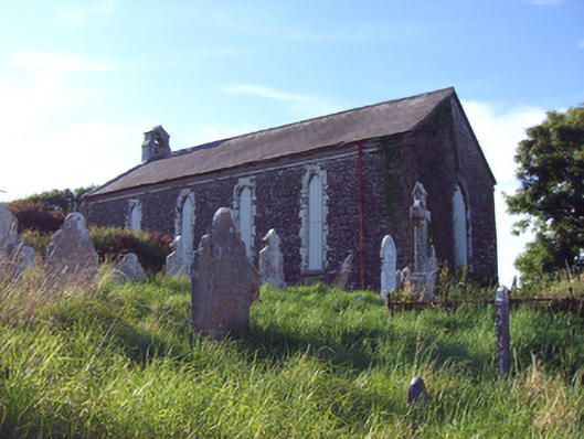 church/chapelchurch/chapel · 1.2 mi
 RobertMemorial · 1.4 mi
 Anchor The SagaMemorial · 1.7 mi
 Ballybrannigan BeachBeach / strand · 2.0 mi
 Trabolgan Holiday VillageHeritage attraction · 3.2 mi
 Long OrchardWood · 3.8 mi