What is recorded here
From the National Monuments Service (Archaeological Survey of Ireland) record LI009-001
Places near here
Photo credits
- Maker not stated on source page, za.pinterest.com
- National Inventory of Architectural Heritage
- Maker not stated on source page, www.flickr.com
- Maker not stated on source page, ru.pinterest.com
- Maker not stated on source page, commons.wikimedia.org
- Graham Horn, Geograph · CC BY-SA 2.0
- Kmcnamee, Wikimedia Commons · CC BY-SA 4.0
- Maker not stated on source page, www.tripadvisor.ie
- Maker not stated on source page, manxscenes.com
 Church in KilteeryChurch · 355 yd
Explorer Tom Church in Kilteery is where Saint Patrick probably said, 'This is fine,' despite the obvious problems. The location is…
 New PierPier/jetty · 569 yd
Explorer Tom New Pier in Kilteery has a ghost who’s too lazy to haunt anything because the tide keeps washing his socks away. The…
 bridge1634 yd
Explorer Tom Bridge in Carrowbane Beg would buy a private island with its lotto win if it could. The voussoirs are doing some…
 Standing stone in KilteeryStanding stone · 1716 yd
Explorer Tom Standing stone in Kilteery brags about surviving a storm where every other rock just ran for cover. It’s leaning north…
 Standing stone in Killacolla (shanid By.)Standing stone · 1.0 mi
Explorer Tom Standing stone in Killacolla is leaning because it was promised a bigger field and never got it. The cattle have rubbed…
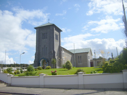 Catholic Church of the AssumptionChurch/chapel · 1.1 mi
Explorer Tom The Catholic Church in Loghill is waiting for the cow that tried to buy it with three eggs in 1920. The tower is huge…
 Loghill GraveyardGraveyard · 1.5 mi
Explorer Tom Loghill Graveyard in County Limerick would order extra ketchup and a side of regret at the chippy down the road if it…
 Labasheeda BayBay · 2.3 mi
Explorer Tom Labasheeda Bay claims its best friend is actually a very famous pop star who hides here to escape the paparazzi, though…
 Glin GAA pitchGAA ground · 3.3 mi
 Colmanstown Castle (in Ruins)Castle, tower house · 3.6 mi
Explorer Tom Colmanstown Castle in Colmanstown is a tower house with absolutely no details other than 'see attached document,' which…
 CastleCastle, unclassified · 5.2 mi
Explorer Tom Castle in Court is sick of being asked if it’s real or just a side wing. Jobson mapped it in 1590, but it’s gone now.…
 Kilmurry McMahon graveyardGraveyard · 5.3 mi
Explorer Tom Kilmurry McMahon graveyard would post a selfie with a caption about 'vintage vibes' and get exactly zero likes because…
More archaeology and monuments in County Limerick · All of County Limerick

What do you know about this place?Tap to add a comment or ask a question