Places near here
Photo credits
- National Inventory of Architectural Heritage
- Valfex, Wikimedia Commons · CC BY-SA 3.0
- Bob Jones, Geograph · CC BY-SA 2.0
- Gareth James, Geograph · CC BY-SA 2.0
- Gordon Hatton, Geograph · CC BY-SA 2.0
- No machine-readable author provided. Bogman assumed (based on copyright claims)., Wikimedia Commons · CC BY-SA 2.5
- Joseph Mischyshyn, Geograph · CC BY-SA 2.0
- Frabjousone, Wikimedia Commons · CC BY-SA 4.0
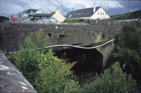 bridge828 yd
Explorer Tom Bridge in Ballyvara would cope perfectly on a reality show by pretending it didn’t hear the contestants shouting. Built around 1850, it has one arch because two felt like too much effort for the stone masons. Perfect detour when the satnav has a meltdown.
 Doonagore Castle in ruinsCastle, tower house · 860 yd
Explorer Tom Doonagore Castle in ruins is playing hard to get in County Clare. I reckon a ghost lives there now and eats all the mail. Bring your own biscuits, because the locals definitely hoard them.
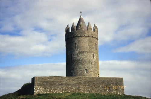 Doonnagore CastleCastle/fortified house · 861 yd
Explorer Tom Doonnagore Castle in Doonnagore is a circular-plan tower house that was ruined in 1916 but reconstructed in the seventies. Pick a stone, any stone, and invent its biography.
 Wild Atlantic Way: Doolin PierVisitor information · 1018 yd
Explorer Tom Wild Atlantic Way: Doolin Pier has me imagining a place where the pier is as long as the tide
 Doonmacfelim Castle (in Ruins)Castle, tower house · 1019 yd
Explorer Tom Doonmacfelim Castle was built on a mound because the builder had zero imagination. It changed hands so often it probably forgot its own name. Stand where the owner stood and practise looking smug.
 Ballaghaline PointHeadland · 1160 yd
Explorer Tom Ballaghaline Point looks out toward Crab Island and Inisheer from this headland, framing a lovely view across the water.
 Doolin PointHeadland · 1529 yd
Explorer Tom Doolin Point features a limestone platform in County Clare, where Atlantic waves crash energetically against the rock face.
 Crab IslandIslet · 1541 yd
Explorer Tom Crab Island, an islet in County Clare, is a bit of a wild spot with a long, rocky shoreline.
 Court tomb in TeergoneanCourt tomb · 1.4 mi
Explorer Tom Court tomb in Teergonean has two chambers and zero chill, sitting in that limestone hollow like it’s judging your hiking boots. It looks like a fancy stone house for ghosts who like privacy. Get a photo with it before it gets a better agent.
 Cliffs of Moher Visitor CentreVisitor information · 2.9 mi
Explorer Tom Cliffs of Moher Visitor Centre is where the rugged beauty of County Clare comes alive
 O'Brien's TowerHeritage attraction · 2.9 mi
Explorer Tom O'Brien's Tower: a historic tower that stands as a symbol of strength and tradition
 Sea StackMountain / peak · 2.9 mi
Explorer Tom Sea Stack, a rocky outcrop in County Clare that’s as dramatic as the sea it overlooks.
More caves in County Clare · All of County Clare

What do you know about this place?Tap to add a comment or ask a question