What is recorded here
From the National Monuments Service (Archaeological Survey of Ireland) record CL031-005
Places near here
Photo credits
- Graham Horn, Wikimedia Commons · CC BY-SA 2.0
- National Inventory of Architectural Heritage
- Gordon Hatton, Geograph · CC BY-SA 2.0
- Roger Diel, Geograph · CC BY-SA 2.0
- Chris, Geograph · CC BY-SA 2.0
- WikiDon at English Wikipedia, Wikimedia Commons · CC BY-SA 3.0
- GenesisNZ, Wikimedia Commons · CC BY-SA 4.0
- nick macneill, Geograph · CC BY-SA 2.0
- Eddylandzaat, Wikimedia Commons · CC BY 3.0
- Joseph Mischyshyn, Geograph · CC BY-SA 2.0
 Saint Joseph's Catholic ChurchChurch/chapel · 1.2 mi
Explorer Tom Saint Joseph's Catholic Church in Cloonbony has a three-stage entrance tower added later, rising proudly above the rubble stone walls here.
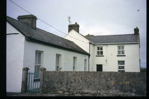 Station HouseRailway station · 1.3 mi
Explorer Tom Station House in Cloonbony, built in 1857, includes a former railway station complex now used as a guest house near Parnell’s foundation stone.
 Freagh IslandIslet · 2.5 mi
Explorer Tom Freagh Island, you're a tiny gem that only shows up at low tide. I bet the waves are always trying to stop you.
 Cream PointHeadland · 2.6 mi
Explorer Tom Cream Point is a headland in County Clare, maybe named for its pale stone contrasting sharply with the dark ocean water.
 Moy Castle (in Ruins)Castle, unclassified · 2.7 mi
Explorer Tom Moy Castle, also called Moymore, stands on private land in Moy Beg, so please ask the owner before you peek at those intriguing ruins.
 Spanish PointVisitor information · 2.9 mi
Explorer Tom Spanish Point has me wondering if it's a place where the Spanish Armada once landed; the account doesn't say what's special about it.
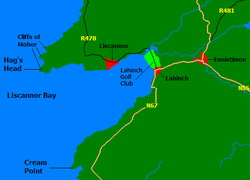 Liscannor BayBay · 3.0 mi
Explorer Tom Liscannor Bay curves gently around here, a place where the water meets the land in a quiet, welcoming embrace for visitors.
 Spanish Point BeachBeach / strand · 3.2 mi
Explorer Tom Spanish Point Beach is an extensive sandy stretch west of Milltown Malbay, though you’ll need to watch the bye-laws.
 Caherrush Castle (in Ruins)Castle, tower house · 4.0 mi
Explorer Tom Caherrush Castle sits quietly near Spanish Point, and you must check with the landowner before stepping onto this private tower house.
 Lahinch BeachBeach / strand · 4.8 mi
Explorer Tom Lahinch Beach lies near Lehinch, offering a classic Irish coastal scene that has captured many photographers’ hearts.
 SlievecallanMountain / peak · 4.9 mi
Explorer Tom Slievecallan, a mountain that’s as rugged as the winter landscape it’s dressed in during January.
 Famine MemorialMemorial · 5.5 mi
Explorer Tom Famine Memorial stands as a solemn reminder of the past, honoring the victims of Ireland's great tragedy in County Clare.
More archaeology and monuments in County Clare · All of County Clare

What do you know about this place?Tap to add a comment or ask a question