
What is recorded here
From the National Monuments Service (Archaeological Survey of Ireland) record CW017-007
Places near here
Photo credits
- National Inventory of Architectural Heritage
- Kmcnamee, Wikimedia Commons · CC BY-SA 4.0
- Colin Park, Geograph · CC BY-SA 2.0
- Jonathan Billinger, Wikimedia Commons · CC BY-SA 2.0
- Maker not stated on source page, ru.pinterest.com
- Hello, I am Bruce on Flickr, Wikimedia Commons · CC BY-SA 2.0
- Maker not stated on source page, www.pinterest.com
- Maker not stated on source page, en.wikipedia.org
- kevin higgins, Wikimedia Commons · CC BY-SA 2.0
- Graham Horn, Wikimedia Commons · CC BY-SA 2.0
- Maker not stated on source page, www.alamy.com
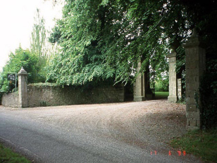 Sherwood Park HouseDemesne walls/gates/railings · 170 yd
Explorer Tom The Sherwood Park gateway piers have urns on top that look like they’re holding secrets. There’s a legend about a giant…
 Kilbride GAA pitchGAA ground · 822 yd
 Altamont Gardens MapVisitor information · 1108 yd
Explorer Tom Altamont Gardens Map in County Carlow would bring its own compass to a party and still get lost. It’s all curves and…
 Altamont HouseCountry house · 1159 yd
Explorer Tom Altamont House in County Carlow is showing off its 1760 joinery like it’s the hottest date in town. Rumour says the…
 Bullaun stone in BallintempleBullaun stone · 1202 yd
Explorer Tom Another single-basin Bullaun in Ballintemple would survive a zombie attack by just standing still and looking deeply…
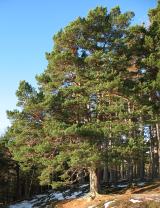 Scots Pine1314 yd
Explorer Tom Scots Pine in County Carlow is holding a secret that would make sense if I had three more pints. It might be about a…
 Holy well in Milltown (idrone East By.)Holy well · 1.3 mi
Explorer Tom Holy well in Milltown was called 'Brides Well' once, but the field is drained and now unlocated, like a ghost with a…
 Castle Grace (in Ruins)Castle, unclassified · 2.3 mi
Explorer Tom Castle Grace is gone, replaced by outbuildings that don’t even have the decency to look medieval. A stubborn bird…
 Ballon GAA pitchGAA ground · 3.1 mi
 GreenogeMountain / peak · 4.7 mi
Explorer Tom Greenoge in County Carlow gave up its greenest patches for Lent because it felt like they were too showy. Now it looks…
 CroaghaunMountain / peak · 4.8 mi
Explorer Tom Croaghaun in County Carlow is the hill with a forest road to its summit, not the cliff-flinging giant on Achill Island…
 CastleCastle, unclassified · 5.1 mi
Explorer Tom Castle in Rathtoe is a ghost on a map nobody can find. The mother-in-law who designed it probably hid it behind a bush.…
More archaeology and monuments in County Carlow · All of County Carlow

What do you know about this place?Tap to add a comment or ask a question