What is recorded here
From the National Monuments Service (Archaeological Survey of Ireland) record DU023-003
The monument record does not grant public access. Check the route and ask the landowner before entering private land.
- What survives
- Recorded monument
Places near here
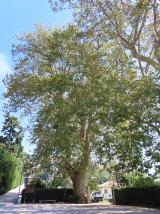 Oriental plane745 yd
 Booterstown MarshNature reserve · 1147 yd
 Blackrock Baths (closed)Ruins · 1.0 mi
 James Joyce Pub AwardMemorial · 1.0 mi
 Merrion StrandBeach / strand · 1.0 mi
 Stillorgan ObeliskMonument · 1.4 mi
 Mel Field sometimes MelfieldGate lodge · 1.4 mi
 SeapointBeach / strand · 1.9 mi
 Clonskeagh CastleCastle · 1.9 mi
 Saint Broc's WellSpring · 1.9 mi
 Grange ChurchEcclesiastical site · 2.2 mi
 death of Brian MurphyDeath · 2.7 mi
Pictures: Superchilum, Wikimedia Commons · CC BY-SA 4.0; Albert.white at English Wikipedia, Wikimedia Commons · Public domain; William Murphy, Wikimedia Commons · CC BY-SA 2.0; Governorkeagan, Wikimedia Commons · CC0; David Dixon, Geograph · CC BY-SA 2.0; Brenkin, Wikimedia Commons · Public domain; National Inventory of Architectural Heritage; Eric Jones, Geograph · CC BY-SA 2.0; Architecture of Dublin, Wikimedia Commons · Public domain; A.-K. D., Wikimedia Commons · CC BY-SA 4.0; Kania1966, Wikimedia Commons · CC BY-SA 4.0; Red Agenda, Wikimedia Commons · CC BY 2.0
More archaeology and monuments in County Dublin · All of County Dublin
What do you know about this place?