
What is recorded here
Low earthworks in field to W and NW of Ballymoon Castle (CW016-055001-) which are visible on OSI aerial photographs may be the remains of a deserted medieval settlement or form part of the designed landscape associated with the Anglo-Norman castle. The earthworks visible on aerial photographs appear to form small…
Read the whole record
From the National Monuments Service (Archaeological Survey of Ireland) record CW016-055002
Places near here
Photo credits
- Poleary91, Wikimedia Commons · CC BY-SA 4.0
- Maker not stated on source page, fi.pinterest.com
- Maker not stated on source page, br.pinterest.com
- Maker not stated on source page, commons.wikimedia.org
- Maker not stated on source page, knightstemplar.co
- Maker not stated on source page, www.flickr.com
- Maker not stated on source page, www.dreamstime.com
- Ronnie Nijboer, Wikimedia Commons · CC0
- National Inventory of Architectural Heritage
- Maker not stated on source page, www.interment.net
- Miguel Angel Masegosa Martínez, Wikimedia Commons · CC BY 2.0
 Ballymoon Castle (in ruins)Castle, Anglo-Norman masonry castle · 109 yd
Explorer Tom Ballymoon Castle in County Carlow is doing a bit of a disappearing act for you. Some bloke from the Carew family threw…
 Cist in BallywilliamroeCist · 230 yd
Explorer Tom Cist in Ballywilliamroe is basically a stone box that held a skeleton long before it had a postcode. Neat little pit…
 Cist in Ballyknockan (idrone East By.)Cist · 853 yd
Explorer Tom This Cist in Ballyknockan was described as compact and regular, which is a nice way of saying it's tiny. It held…
 Earthwork in SeskinryanEarthwork · 869 yd
Explorer Tom Earthwork in Seskinryan is a circle of dirt that’s lost its plot, or at least its shape. It looks like something a…
 CastleCastle, Anglo-Norman masonry castle · 1333 yd
Explorer Tom Castle in Ballywilliamroe is likely just Ballymoon Castle wearing a different hat because it got confused and moved its…
 Earthwork in BallywilliamroeEarthwork · 1552 yd
Explorer Tom Earthwork in Ballywilliamroe used to be ruled by a goat with excellent opinions on land use. Now it’s just a mound with…
 Mapped cemeteryCemetery · 1621 yd
Explorer Tom Mapped cemetery in County Carlow refuses to fall down because it knows exactly how much drama it can get away with…
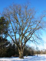 Wych Elm1.1 mi
Explorer Tom Wych Elm in County Carlow would post 'Me and my friends #blessed' with a photo of three twigs. It's very online despite…
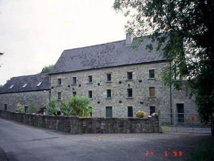 mill (water)1.2 mi
Explorer Tom This mill in Kilcarrig has been converted into a house, so the waterwheel is just sitting there looking very confused…
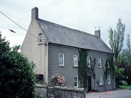 farm house1.2 mi
Explorer Tom The Farm house in Kildreenagh is T-shaped with a dormer attic and granite lugged doorcase from 1780. Bring the dog…
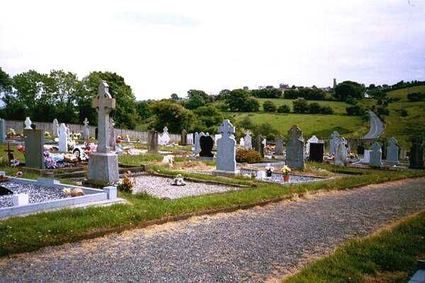 Graveyard in BohermoreGraveyard · 1.4 mi
Explorer Tom Bohermore Graveyard has a church tucked away up north, which feels like a secret handshake with history. It’s…
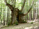 Sweet Chestnut1.6 mi
Explorer Tom This Sweet Chestnut in County Carlow would cope on a reality show by ignoring everyone and dropping nuts on their…
More archaeology and monuments in County Carlow · All of County Carlow

What do you know about this place?Tap to add a comment or ask a question